Glacier Phenology

Elizabeth Kimberly is a graduate student at Western Washington University. This year she received a Mazama Research Grant for her project titled “Testing the viability of using structure-from-motion photogrammetric surveys to Track glacier mass balance and meltwater discharge on the Easton Glacier, Mt. Baker, Wash.” Below is a reflection on her recent field work.


Article & photos by Elizabeth Kimberly

In the past, I’ve associated the concept of phenology with flowers and trees undergoing seasonal transformations from buds to blooms. However, conducting research on the Easton Glacier the past several months for my Masters thesis has shown me the remarkably striking ways in which mountain-scapes, too, change with the seasons. These are the abiotic parts of nature that we typically think of only being subject to change over centuries and millennia, not days and months … so much for a “glacial pace.” Here, I write about the phenology of the Easton Glacier through the spring and summer of 2018.

Early May

It is early May and the birds are chirping dawn choruses and the winter rain has diminished. The disparity between the snowy alpine and the verdant lowlands is increasingly stark. Stubborn patches of snow still make the trailhead’s rugged forest road impassable and when we arrive, the snowmobile crew has finagled a winch system to pull their burly trucks and sled trailers across. We giggle at their innovation as we attach skins to our skis, complete a most unusual gear check (duct tape? steam drill? PVC pipes? avalanche gear? snacks?), and finish our coffee.

A team of 8, all members of the Northwest Cruisers Snowmobile Club, has united to help us transport our heavy, bulky research gear up the Easton Glacier and nearly to the summit of Mount Baker. In less than 20 minutes our crew has zoomed from 3,000 feet to 8,500, across cobble-filled creeks and dormant underbrush and unconsolidated glacial till and deep crevasses, all obscured by meters of snow. The undulations of the topography are softened by the snow-laden landscape and the terminus of the glacier is indistinguishable so early in the season.

Niki and I follow a pre-set GPS track to find our first site. Our goal for the day is to use a steam drill (not to be mistaken for a sasquatch-sized espresso-maker) to drill five stakes into the snow and ice, which we’ll revisit through the summer and fall to measure changes in the surface elevation. We probe each survey site to ensure we don’t inadvertently install a stake into a crevasse, and to approximate the depth of the snowpack. When we’re finished, we enjoy the payoff: a ski through thousands of feet of soft spring corn to sites 4, 3, 2, and 1, where we repeat the installation process.

Mid June

By mid-June, the snow bridge across the Easton Glacier’s outlet creek has melted and the low albedo of the cobbles has revealed interwoven stream channels and vegetation. The glacier is no longer accessible via snowmobile and so we approach the ice with an awkward tango of skiing, skinning, hiking, and bush-whacking. We’re wearing shorts and we are disoriented because the glacier’s foreground has morphed into a mosaic of snow, dirt patches, and moving water. “Didn’t we ski right over that waterfall just a month ago?”

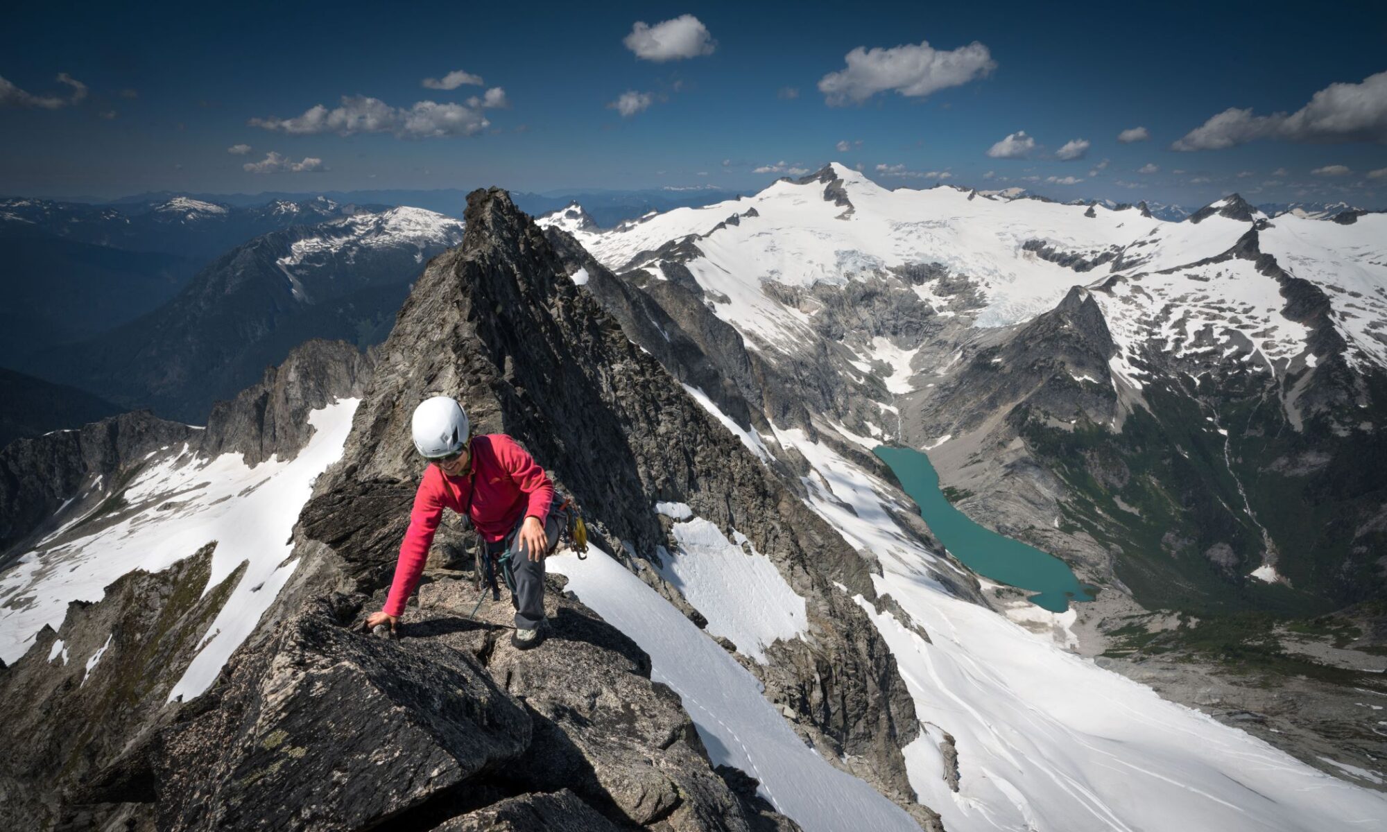
We arrive at the first stake and measure 127 centimeters worth of snow-melt since its installation a month ago. There’s a spider perched on the stake, totally unaware of the climatic changes unraveling around it. We continue up the center of the glacier, moving more delicately and swiftly in certain, seemingly thin places. Sometimes we straddle deep crevasses and peer down into the frozen abysses. Like stratigraphic columns that reveal a chronology of shorelines, the cracks expose layers of snow, firn, and ice from seasons passed.

It’s 3 pm and we’ve made it to stake 3. The snow appears to have gone through a melt-freeze cycle recently and the corn tempts my skiing instincts. On a whim, we decide to pause our research efforts and jaunt up toward the summit of Mount Baker. After all, it might be our last chance to ski volcano corduroy. Around 6:30 pm, we strip our skins and fly down the glacier, at the mercy of gravity and with the current of a disappearing frozen river.

Late July

It’s late July and now we’re wearing hiking boots. There’s a heat-wave in the valley, the trailhead is packed with day-hikers, and we’ve replaced ski poles with crampons and avalanche gear with glacier ropes. The goals of our visit are varied, but first on our list is to install a second stream gauge and measure the creek’s velocity. What’s the diurnal variation (i.e. How much does the streamflow change as the day warms? Can we attribute its velocity changes to snow-melt and/or glacial-melt?)?
After an afternoon of drilling holes into rocks (to install our “level-logger,” a device that continuously measures the stream’s height, which we use to make a curve that relates stream stage to velocity throughout the summer) and standing in glacial streams, we find ourselves sprawled in a wildflower-filled alpine meadow, eating macaroni and cheese and talking about unscientific things. Does the full moon pull on the glacier the way it pulls on the tides?

On our second day, we return to the highest stake for the first time since May. We’re attached to the same rope, five meters apart and moving simultaneously across the ice, navigating mazes of crevasse fields and ice-fall. Sometimes we rearrange our rope’s trajectory to ensure we remain perpendicular to the visible crevasse patterns. We scan the glacier for stake 5 and Katie spots it at the mouth of a widening crack. Oops.

We arrive at stake 3 and the snow has melted a total of 355 centimeters in two months. The untouched field of white snow from a month prior is now striped with fissures. The crevasses concentrate in places where the glacier is moving most quickly, typically along convexities in the topography. Stake 1 is guarded by a cliff of unconsolidated sediment, the remnants of the glacier’s path, and it’s inaccessible from above. We contemplate what climbing Mount Baker will be like in 50 years, and the recently revealed uneven, unstable rocky terrain at the ice’s edges offer compelling evidence.

As we leave the glacier and return to our campsite, I baffle at the delicate heather buds waltzing in the wind. This sea of wildflowers is a product of millennia of eruptions and glaciations and burrowing marmots. I can reasonably predict what this landscape will look like when we return at the end of September, and again in February. But I can only speculate how long it will take for the summit of this glaciated volcano (currently a bright white beacon in the sky and only accessible with crampons and ice axes), to become a cirque with an alpine lake, shaded by subalpine firs and fit for hiking boots and sunset picnics.

A Legacy on the Landscape

by Mathew Brock, Mazama Library and Historical Collections Manager


Place names are integral to our knowledge and understanding of Mazama history. The nomenclature of Pacific Northwest geographic features, more often than not goes unrecognized and is often forgotten. Unknown to most, the Mazamas and its members have influenced the names of many places around the Northwest. The story begins, as many recountings of Mazama history does, with our founder William Gladstone Steel.

William Steel, Mt. Hood, and Mt. Mazama

Besides founding the Mazamas and helping to establish Crater Lake National Park, the nomenclature place names fascinated Steel. He worked for many years to compile a catalog of over 40,000 place names. It seems only fitting then that Steel Cliff on Mt. Hood honors him. Steel is also responsible for the naming of Mt. Hood’s Illumination Rock and Mississippi Head. In 1887 he organized and led a party that carried 100 pounds of red fire up to the mountain’s top and set them alight as part of that year’s July 4 celebration. Anyone who could see the mountain that night could see the fire atop Illumination Rock. In 1905 Steel named Mississippi Head for that state’s delegation to the National Editorial Association, who held their annual convention in Portland that year.

While on the subject of Mt. Hood, the Mazamas have either named or have influenced the naming of several other prominent features on the mountain. In 1901 the Mazamas named Reid Glacier for Professor Harry Fielding Reid of Johns Hopkins University to honor his work studying glaciers. Others include the naming of Glisan Glacier for long-time member Rodney L. Glisan and Leuthold Couloir for Mazama Joseph Leuthold. In the late 1990s, the U.S. Forest Service renamed the Cathedral Ridge trail the Mazama Trail to recognize the organization’s long association and history with the mountain.

All this pales in the satisfaction Steel must have felt when, in 1896, the ancient mountain whose caldera now holds Crater Lake was named Mt. Mazama in honor of the organization he founded. Steel loved Crater Lake and worked for seventeen years to have the area declared a National Park. He later served as the park’s second superintendent.

Columbia River Gorge

In 1914 the State Highway Commission asked Mazamas to recommend names for some of the places along the Columbia River Highway. The council sanctioned a committee to study the issue and make recommendations. In 1915 the committee submitted their proposals to the Mazamas and the Highway Commission. The commission accepted the majority of the recommendations. We know them today as Metlako Falls, Munra Point, Ruckel Creek, Tumult Creek, Wahclella Falls, Wahe Falls, Wahkeena Falls, Wuana Point, Elowah Falls, and Yeon Mountain. Don Onthank, a long-time member known to many as Mr. Mazama, gave the name to Bruin Mountain and the Rock of Ages Trail, both in the Gorge. And for a short while, there existed a Mazama Mystery Trail in the Gorge in the vicinity of Saint Peter’s Dome.

Mt. Adams, Mt. Baker, and Mt. Rainier

The Mazamas influence extends beyond Hood and the Gorge. Mazama and northwest mountaineer Claude E. Rusk is the namesake of Rusk Glacier on Mt. Adams. On Mt. Baker, the Mazama Dome honors the organization, while the Mazamas named Roosevelt Glacier in 1906 for U.S. President Theodore Roosevelt.  The Mazamas is the namesake for the Mazama Glaciers on both Adams and Baker. The Mazamas petitioned in 1948 to have the Mazama Glacier on Mt. Adams renamed to honor five-time Mazama President Charles Sholes, but the request was denied. Mazama founding member Fay Fuller is the source for Fay Peak, on the slopes of Mt. Rainier.

Forest Park

Closer to home, the Mazamas advocated for the creation of Forest Park. For their efforts, the city allowed for the establishment of the Mazama Forest inside the park. Now all but forgotten, this area was overseen by the Mazamas. Besides planting thousands of trees, the Mazamas sourced various types of rhododendrons from around the region and transplanted them. The Hardesty Trail leading to the forest honors Mazama President William Hardesty.

Mount St. Helens

Until the summer of 1967, all the glaciers on Mount St. Helens were nameless. In May of 1966, Keith Gehr, a frequent Mazama climb leader and then head of the Mazama Outing Committee, set out to rectify the situation. Over three months Keith worked the phones and wrote countless letters to determine why there were no given names. Keith’s search turned up an ally when he contacted Dr. Mark Meier, a glaciologist for the U.S. Geological Survey (USGS). After getting assurances from the USGS that the 11 permanent ice bodies on the mountain were, in fact, actual glaciers, Keith and Mark set about researching and submitting names for them. Keith wrote, “After much research in the Mazama library on the early history of the Mt. St. Helens area, particularly as it is related to climbing, a set of names was proposed. Differences of opinion between the Mazamas, Forest Service, and Geological Survey were quickly resolved in across-the-table meetings.” The eleven names recommended were: Forsyth, Nelson, Ape, Shoestring, Swift, Dryer, Talus, Toutle, Wishbone, Loowit, and Leschi. In November of 1967, the Board of Geographic Names, based in Washington D.C., approved the Mt. Saint Helens glacier names based on recommendations from the Mazamas.

Three of the names—Forsyth, Nelson, and Dryer—honored individuals. Charles Forsyth led six companions in the first rescue on St. Helens during the 1908 Mazama Outing. Over a grueling 48-hours, he led north-south and south-north traverses of the mountain to bring an injured climber to safety. Lorenz Nelson, a pioneer of Northwest mountaineering, 50-year Mazama member, and a two-time president is the namesake for the Nelson Glacier. Thomas Dryer was the founder and first editor of the Oregonian newspaper and a member of the party that first climbed St. Helens in 1853. The remaining glaciers took their names from either their shapes or from Native American heritage. Unfortunately The 1980 eruption vaporized Wishbone, Loowit, and Lesch glaciers and significantly reduced Nelson, Shoestring, and Forsyth glaciers.

Diligent searches through almost a hundred years of Mazama Bulletins has turned up many other places named for or by the Mazamas and its members. To name a few of the more interesting and unique: Lost Park in Beaverton; the Mazama Campground at Crater Lake; Sahale Peak near Washington’s Lake Chelan was named for the organization’s motto; Mt. Thielsen’s Lathrop Glacier, for Mazama Theodore Lathrop; and finally the small seasonal lake that appears atop South Sister was named Teardrop Lake by three young Mazamas on a hike.

While this recounting of place names around the Northwest is in no way comprehensive, it provides a glimpse into the influence the Mazamas have had on the nomenclature and the history of the region. Place names are anchors by which the Mazamas are tied to the mountains, valleys, glaciers, and ridges and act as markers of where the organization has traveled, climbed, and camped. As the Mazamas enter into their 124th year, the places named for and by the Mazamas are a proud reminder of the organization’s long and deeply rooted legacy on the landscape.

Star Dust

by Darrin Gunkel

The Summer Triangle

You’re standing on the side of a mountain, about 7,000 feet above sea level. It’s a few minutes after sundown and the color filling the western sky has you absorbed. Until you turn to the east and notice something odd. The sky has a pinkish glow but for a dark band of blue along the horizon. This is the Earth’s shadow cast onto the upper reaches of our atmosphere. It’s visible for a brief time after sundown, while the geometry of our sun and planet are just right. Once night fully falls, rather looking at the shadow, you’re standing under it.

The pink glow is called the Belt of Venus, and when it appears, it’s time to start looking for the first stars and planets of the evening. Twilight’s a great time to find your way around the sky – it more closely resembles those constellation finder charts that tend to show only the brighter stars. Things can get confusing later on in full darkness, when the storm of summer stars can throw off even experienced stargazers.

This month, the show begins with the two brightest planets: Venus blazing 15 degrees (or three fist widths) above the western horizon, and Jupiter, 30 degrees up from due south. Both should be easy to spot by 9:30. Just north of east, Vega, the fifth brightest star in the sky (not including the sun) rides a little higher above the horizon than Jupiter.

Vega burns as brightly as it does for three reasons. First, it’s big: two and half times the size of our sun. Second, it’s hot: its surface registers 9500 Kelvin (the temperature scale astronomers use, based on absolute zero. Our sun’s surface is 5770 Kelvin. The average temperature of the Earth’s surface is 287 Kelvin, or 57.2 degrees Fahrenheit.) Vega’s hotter, larger, and brighter than the vast majority of the 200 billion to 400 billion stars in our galaxy. Finally, Vega’s nearby, a galactic neighbor at 25 light years.

Vega is also the anchor for the bright summer asterism, or pattern of stars, known as the Summer Triangle. The second star in the group, Altair, is rising due east after sundown. By 10:00, it should have cleared the murk of dust and haze near the horizon. Altair has an entourage. Just above and below are the slightly dimmer Tarazed and Alshain, respectively. Altair’s not as bright as Vega because it’s neither as big nor hot. In fact, it’s much closer, clocking in at 16.7 light years.

Neither of them, however, holds a candle to the final member of the Summer Triangle. Deneb, found about 30 degrees above north-northeast as twilight deepens into full night. It’s among the largest and brightest stars in the galaxy, a super-giant 100 million miles in diameter. That’s not a typo. Deneb is wider than the distance between the Earth and Sun. Intrinsically, Deneb is something like 55,000 times brighter than our home star. Move it to Vega’s distance and it would be clearly visible during the day and cast shadows at night. But it’s 60 times further away, shining at us across 1500 light years, so it only ranks as the 19th brightest night time star.

Incidentally, big, bright stars are rare. Our Sun is a good example, often misidentified as average, though anything but. It’s larger and brighter than 90 percent of the stars in our galactic neighborhood. Of our 50 nearest stellar neighbors, only seven are bright enough that we can see them without the help of binoculars or a telescope, and only three of those are truly bright, first magnitude stars. Relatively close neighbors Vega and Altair don’t even make that list. A few of the rest can be spotted with binoculars, but most are tiny red dwarfs, often closer in size to the giant planet Jupiter than to our sun, and invisible with anything other than a seriously large telescope.

The Great Rift

As the night deepens, dimmer stars fill up the sky: the little parallelogram that hangs like a pendant below Vega, marking the constellation Lyra; the splay of stars to the south of Altair, the constellation Aquila; the Northern Cross capped by Deneb. And then there’s the Milky Way, the collective glow of billions of stars too distant and dim to make out with eyes alone. Together their light forms what the !Kung people of the Kalahari call the Backbone of the Night. The Milky Way runs right through the middle of the Summer Triangle, and through the middle of it runs the Great Rift.

The Great Rift splits the Milky Way into two streams. The stars aren’t sparser here, they’re obscured by great clouds of cosmic dust: the star stuff that Joni Mitchell and Carl Sagan liked to point out we are all made from. And not just us. Star dust is everything in the solar system that isn’t hydrogen or helium (everything that isn’t the Sun, Jupiter, and Saturn, basically), every planet, asteroid, comet, meteor. Everything on or in every planet, asteroid, comet, meteor. The oceans, the continents, the volcano you’re camping on. Moreover, that star stuff fuels those volcanoes.

The earth is hot inside: cranking at 44 trillion watts. Half of that heat comes from radioactive decay – the breakdown over time of uranium, mostly, but also thorium, potassium and a few others, into lighter elements. This decay unleashes subatomic particles that crash into the other stuff the earth’s made of, and transfer their kinetic energy into that stuff, heating it up. This melts the Earth’s interior, creating the convection driving the plate tectonics fueling mountain – and volcano – building. (The rest of the heat is leftover from the Earth’s formation – also kinetic energy, but from numberless bits of cosmic dust in the Sun’s birth cloud colliding and coalescing under the influence of gravity.)

So where’d all that dusty stuff come from? Back to the stars – the big ones like our Sun, which end their lives as planetary nebulae: glowing shells of future star dust and gas that disperse into the cosmic wind. But to make the really heavy radioactive elements, like uranium, you need really big stars like Deneb. Starlight is (part of) the exhaust of nuclear fusion: hydrogen fusing to helium, and so on to heavier elements. To get the really exotic, unstable radioactive elements like uranium, you need the conditions found only in a supernova, the death-throe explosion of one of those super-rare giants. Super-rare, but remember, there may be a third of a trillion stars in our galaxy, and it’s been around for something like 15 billion years. Plenty of time for plenty of ancient Denebs to cough up enough heavy elements to keep planets like ours cooking up entertaining mountains.

Bringing Kids to the Mountain

By Michael Vincerra

For a few short days in winter, under dreary gray skies, 5th-grade students are transported from the Centennial School District in Gresham and East Portland to the Mazama Lodge at the base of Mt. Hood. Transported not only to an alpine world of snow, adventure, science, and learning, but also to a classroom unlike any other. Volunteers, teachers, and parents assure that these students will spend three weekdays immersed in an alpine classroom, where they “learn how to learn,” with an eye toward stewardship of our natural resources.

For 5th graders who see Mt. Hood’s rugged profile from city streets, arrival at Mazama Lodge means a chance to explore nature and have fun. To parents, teachers, and volunteers, it means the chance to pass on a love of nature and curiosity to 11 and 12 year olds—hoping to inspire another generation of outdoor enthusiasts.

Since its inception in 2015, the Mazama Mountain Science School (MMSS) has grown its student body 4 times over, serving about 150 kids in 2015 to 650 kids in 2017. Whereas in the winter of 2015, it educated 3 schools of 5th grade classes, in 2017, it will educate about 11 schools of 5th grade classes.

The Mazamas partnered with the Centennial School District to fill a gap in the outdoor education system. As a result of this partnership, all seven Centennial elementary schools will be a part of MMSS. Elementary schools from the Portland and Parkrose School Districts also attend. MMSS offers a 5-to-1 adult to student ratio, which means fifth-graders get plenty of outdoor mentoring and skill development in a safe, secure environment, from professional instructors and volunteers.

“We couldn’t do the MMSS without Mazama volunteers, but the majority of the volunteer chaperones are parents of the kids,” says Ann Griffin, MMSS Project Coordinator. Chaperones guide the participants through 14 learning stations—from compass usage, mountain geology, animal tracking, volcanoes, plate tectonics, glaciers, the greenhouse effect, and more. The MMSS curriculum was developed as a collaboration between the Mazamas and the Multnomah Education Service District (MESD), who provides professional instructors. MESD is known for developing Outdoor School for 6th graders and Oregon Trail for the 4th graders. Shauna Stevenson, with the MESD, is largely credited as leading this curriculum development.

Griffin reflects, “I think as an organization we’re asking questions as we grow, ‘How do we make sure that we take care of our volunteers?’ ‘How do we plug people into what they really want to do? How do we make sure that they [volunteers] are recognized?’” In 2017, there are 11 different sessions of approximately 55–60 students who attend Mazama Mountain Science School. In groups of 3 –5, kids move through the learning stations with a chaperone, asking lots of questions. A chaperone could be a Mazama volunteer or a child’s parent. For 2017 Griffin estimates about 7 volunteer chaperones will participate. Mazama volunteers play a critical role as chaperones. For many of the students’ families, it is difficult to take three days off from work, for economic or other reasons. Mazama volunteers fill an important gap.

Freda Sherburne is an Environmental Educator, retired from Metro, and former ODS staff member who volunteers for Metro parks programs, leading K–5 students in science and nature activities. Sherburne volunteered with MMSS in 2015 and 2016. “Because of my background in environmental education, I was also able to take on a teaching role when needed or to help parent chaperones lead their activities.” Sherburne’s professional background was a great asset to MMSS. If only for the fact that children are exposed to alpine environments and their stewardship, the MMSS provides experienced volunteers to these fifth graders, placing them where they can make a big difference. Sherburne muses, “I do remember seeing the joy of the students as they did science activities outside in the snow. For some students, this was their first time on Mt. Hood.”

The MMSS is the centerpiece for Mazama youth outreach initiatives, which include partnering with Centennial School District for grant writing and curriculum development. Yet this is a school. So what are the educational outcomes? The goal is to get more kids into the outdoors. The difference is getting kids curious about things like how densely-packed snow can provide insulation, or how to find true north on a compass or by the North Star, by focusing on nurturing curiosity more than test scores. MMSS continues working with Centennial to find ways to reinforce the lessons that students learn on the mountain—their new classroom. “At the end of the school,” says Griffin, “we ask kids, ‘Do you think that you’d be more likely to come back here (Mt. Hood)?’ When the kids say ‘Yes,’ we consider that a win.

Mazama Mountain Science School
Est: 2015
Mazama Lodge, Mt. Hood
Website: tinyurl.com/MAZMSS
Contact: Ann Griffin,
Mazama Mountain Science School Project Coordinator
anngriffin@mazamas.org
MMC: M–TH: 10:30 a.m.–3:30 p.m.