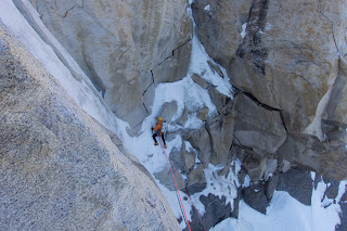
#vanlife

Darrin Gunkel outside his van down by the Alaskan Highway, with a pug.
Photo: Karin Hedlund. 

by Jonathan Barrett


As a parent of a small child, I have a deep, almost primeval, fear of vans. As a child of the 80’s, after school specials and public service announcements warned me against people who called out, “Hey kid! I’m a professional photographer. Come with me to my van, and I’ll take your picture.” As a result windowless van is the first place I am going to look when my son’s face appears on the back of the milk container. The problem is that now, all these vans are filled with beautiful, half-dressed Athleta models and Patagonia ambassadors. Since when did prAna start hiring transients as marketing influencers?

As a result, I find the whole #vanlife thing really confusing, as does my kid. For example, I brought my son, Liam, to Smith last fall. We got out of the car in the bivouac parking lot, and there was a man sitting in the open door of his black Sprinter. Liam grabbed my hand a little tighter and said fearfully, “Daddy, don’t let him take me!” I turned to him and replied, “Don’t worry, son. He has a trust fund. He can’t hurt you.” Liam looked really confused. This man’s fingernails were black. He was barefoot. His beard was thick, but artfully cut. He was shirtless. In his fingers was a funny smelling cigarette. “Daddy, why is he smoking?” Liam asked. “Well, son. Sometimes adults have a hard time coping with reality.”

“So he’s doing drugs?”

“No, that’s why he bought the van. The cigarette is just cloves.”

That evening when we returned to the parking lot, there was a man standing on the roof of a ‘96 Ford Econoline. “Daddy, is he fixing his roof?” Liam asked. I looked at him skeptically. Was he messing with me? The dude was doing downward dog in the fading sunlight. My son had seen me doing yoga in the our privacy of our basement before. He knew I kind of hated it. In his mind, no one would ever do it in public. “Maybe he is looking for a hole that water is coming through,” he offered thoughtfully. The shirtless man in $100 shorts moved gracefully into tree pose. “Oh no!” Liam said. “He’s going to fall off!” A lithe woman appeared on the ground next to the van. “Maybe she will catch him.” She took out her iPhone. “No, wait I think she is going to take his picture. Daddy, why is she taking his picture?”

The rainbow is not Photoshopped. Photo: Darrin Gunkel

“Well, son. Sometimes when you live in a van, it’s hard to stay connected to people. Always moving around. Not being in the same place all the time,” I said. Vanlifer was now doing Pungu Mayuransana, wounded peacock, and the girl continued to take pictures of him. Secretly I wondered: if a climber falls off a van roof in the woods, can anyone hear him scream?

“So, he’s homeless. We should give him something to eat. He can have my apple. I still have it from our hike.” He started to reach into his bag.

By this time the man had finished his poses and was climbing down off the roof of his van. He took a long swig from his Hydroflask. “Honey!” he called to his partner, “Can you check the Goal Zero batteries? There is a crack in the solar panel cable. It might not be charging.”

“‘Scuse me,” Liam said. “Here. You can have this.” He held out his apple in a gesture of sincere concern.

“Is it organic?” he asked. Liam looked at him blankly as the man took it to inspect the sticker.
“Thanks kiddo, but I am really careful with my body. You can keep it,” he said as he handed it back.

As Liam and I walked back to the car, he shook his head. “What’s the matter, bud?” I asked.

“That guy. He makes bad choices. Maybe that’s why he’s homeless.”

“What do you mean?” I asked.

“He said he wants to take care of his body, but he was being very unsafe on the roof. And look,” he said as he pointed back in the direction of the van where the man was walking across the parking lot in his bare feet. “He should put some shoes on so he doesn’t cut his foot.”

Back at our friend’s house in Bend, Liam climbed into their truck-bed camper which served as guest quarters when we visited them. It was 8 p.m, his regular bedtime. “Daddy,” he said. “I’m really glad that we live in a house.”

“Why is that, bud?” I asked as I tucked him in with his stuffed moose, Mary.

“Because I’d miss my friends if we were always moving around, like that guy we saw today.”

“Well, I suppose that’s a fair point,” I said. How could I explain the fact that these people likely have many friends and acquaintances spread across the West, people that they regularly meet at Indian Creek or in Squamish. How could I explain that much of their community was online and digital? That even though they can open their doors and make a parking lot their new front yard, they can’t always know who their neighbors will be from one day to the next. That they are sacrificing a degree of regular, in-the-flesh human contact for space and mobility.

I pulled the fleece blanket up against his chin. “Well. They have friends online who like to see their pictures. They can share their lives that way,” I said.

“Oh,” Liam said. “Well, I like knowing that Owen is just up the street. And that he’ll always be up the street. He’ll never move away.”

“Yeah, kiddo. I don’t think that I would want to live on the road like they do, either.”

“What’s it like to live in a mobile home?” he asked as I was just opening Captain Underpants to read the next chapter to him.

“Well, actually it’s not really a mobile home,” I said.

“Oh, I mean RV.” I put the book down. How was I to explain that it was their home but not a mobile home. That old people live in RVs and go to national parks, like Yosemite. That young people live in vans and … go to national parks, like Yosemite. But it’s not the same.

“It’s a van, son. Let’s just read some of the book so you can get to sleep on time.” Somehow the world of an ill-tempered grade school principal who transforms into a superhero made more sense to him in that moment than the subtleties of #vanlife.

We all remember the Chris Farley SNL sketch where he admonishes David Spade and Christina Applegate to get their lives in order, otherwise they will be, “living in a van down by the river.” Maybe my point of view needs to shift. Maybe there is nothing wrong at all with childless men living in a van down by the river. After all, if my son becomes one of them, I know where to find his picture.

Book Review: The Nature Fix: Why Nature Makes us Happier, Healthier, and More Creative

Author: Florence Williams; Reviewer: Brian Goldman

Have you ever wondered what compels hikers and climbers to endure fatigue, insect bites, blisters, and cold? Is there something about immersion in nature that we inherently need? Are we collectively suffering a “nature deficit disorder?” Do some countries have better national policies of improving health by providing access to nature? Florence Williams, author of The Nature Fix, traveled the world to uncover studies in neuroscience, medicine, and big data about the restorative influence of nature on our physical and mental health. In short, informative, and witty chapters, Williams displays a gift for clearly explaining the science behind nature’s positive effects on our brain and health.

In Japan, where they’ve coined the word karoshi—death from overwork—the government is creating over one hundred forest therapy sites for people to engage in shinrin yoku, forest bathing. Williams visited Yoshifume Miyazaki, a physical anthropologist whose research found that when people take forest walks, there is a 12 percent decrease in cortisol (your body’s main stress hormone), a 7 percent decrease in sympathetic nerve activity (which governs fight-or-flight behavior), a 1.4 percent decrease in blood pressure, a 6 percent decrease in heart rate, and a better mood and lower anxiety. In a country with a high suicide rate and tsukin jigoku—commuting hell—where workers shove you into a train during rush hour, nearly 25 percent of the population now walk forest therapy trails yearly. As Miyazaki explains, “we’ve spent 99.9 percent of our time in nature, a feeling of comfort can be achieved if our rhythms are synchronized with those of the environment.”

Immunologist Qing Li, a collaborator with Miyazaki, has studied natural killer (NK) immune cells, a type of white blood cell that can send self-destruct messages to tumors and virus-infected cells. Sure enough, three days of hiking boosted these NK cells by 40 percent for an entire week. Although not completely confirmed, Li suspects that NK cells are boosted by phytoncides, otherwise known as “nice tree smells.” These are essential oils emitted by evergreens and other trees. Li himself uses a humidifier with cypress oil in his house since he found that those who sleep inhaling a cypress scent experience a 20 percent increase in NK cells and less fatigue.

In Korea, where forest bathing is called salim yok, the Forest Agency has established dozens of healing forests with dominant cypress trees. Scientists in Korea confirm the medicinal aspects of phytoncides as antibacterial and capable of “reducing stress 53 percent by lowering levels of cortisol and blood pressure 5–7 percent.” The soil also contains geosmin, which holds streptomyces bacteria, a key to many antibiotics. Two other studies looked at eleven- and twelve-year olds who suffer from “borderline technology addiction” (BTA). After two days in the forest, researchers found lower cortisol levels and improvement in self-esteem. Armed with this research, Korea has planned a National Forest Plan “to realize a green welfare state, where the entire nation enjoys well-being” through work and school programs.

In Finland, economist Liisa Tyrvainen tweaked the experimental design of Miyazaki and concluded that Finns have elevated measures of restoration, vitality, and creativity when walking outside, but they must be in nature at least five hours a month. If you’re outside even longer, “you will reach a new level of feeling better and better,” she concluded.

Singapore is considered one of the top “biophilic cities” in the world. Almost half of the country’s 276 square miles are under some sort of green cover. The population has grown by 2 million; however, the percentage of green space has increased from 36 to 47 percent. Although many of these green spaces are gardens, greenhouses, paths with green corridors, and parks with constructed nature, the government’s vision has succeeded in making this country an oasis in SE Asia. Studies have shown that mortality rates are lower near urban parks.

Other positive health effects of nature: Williams uncovered research in Ohio, Singapore and Australia suggesting that being outside in sunlight stimulates the release of dopamine from the retina, which prevents the eyeball from getting too oblong, thus preventing myopia (nearsightedness).

Awe: According to the author, Irish philosopher Edmund Burke may have understood the effect of transcendent experiences in nature. He traipsed the countryside and found that for something to be “awe-inspiring” there must be “vastness of extent” in which our senses find it difficult to make sense of it—which in turn inspires feelings of humility and a more outward perspective. Dacher Keltner and colleagues at UC Berkeley have found that experiencing awe was the only emotion to significantly lower levels of IL-6, a marker for inflammation. Lower levels are better; higher levels are linked to depression and stress. Keltner also suggests that the emotion awe causes us to reinforce and share emotional connections. Ever wonder why you take those pictures on your cell phones and send them to family and friends?

The book continues by showing how military veterans suffering from Post Traumatic Stress Disorder (PTSD) have diminished symptoms when rafting or backpacking, and how exercise and exploratory play among children increases verbal and math ability, lowers impulsivity, and leads to a threefold decrease in Attention Deficit Hyperactivity (ADHD) symptoms.

Could the positive effects of immersion in nature apply to our educational systems? Yes, indeed. The author states that Germany has more than 1,000 forest kindergartens called Waldkindergarten, where students are out in all kinds of weather. In one instance, after a large tree fell during a storm, the teacher launched a nature-based curriculum in which children sawed off branches to make the tree safe for climbing. In so doing, students practiced dexterity, teamwork and learned about cause and effect. In Scandinavia, 10 percent of preschoolers spend their entire days outside. In Finland, students have recess outside 15 minutes out of every hour. In contrast, two-thirds of the students in this country are Vitamin D (the sunshine vitamin) “insufficient.” In both the U.K. and the U.S.A., rickets, a disease caused by a lack of Vitamin D, has quadrupled in the past 15 years.

The Nature Fix confirms that even small amounts of exposure to the natural world can improve our creativity and enhance our mood. Williams shows how time in nature is not superfluous but is essential to our species. As our modern lives shift dramatically indoors, spending more time in nature is more urgent than ever. As the author succinctly states, “Go outside, often, sometimes in wild places. Bring friends or not. Breathe.”

ICS Spouse Survival Guide

by Becky Nelson

The author, right, and her husband Harry Colas.

So your loved one is considering the Mazama Intermediate Climbing School (ICS).
When my husband announced his intentions last year to apply for the ICS I wasn’t surprised—but I was a little worried.

We had made a Faustian bargain the year before: he would agree to move to my favorite city, Portland, if and only if I would sign up for a basic mountaineering course with him, which of course turned out to be the Mazama Basic Climbing Education Program (BCEP). At the age of six, I floated a similar bargain to my parentas: I would agree to move to Arizona if and only if they bought me a hamster. Six weeks later, in Scottsdale, Busy Bob entered our lives. Despite a debilitating fear of heights and a distaste for anything remotely athletic—coordination is not my strong suit—I figured BCEP couldn’t be half as bad as owning a pet hamster so we shook on it, moved to Portland, and six weeks later jumped into BCEP.

And we had a total blast! But while I loved my BCEP experience, ICS felt like another beast altogether: a big, scary, massive time suck of a class colorfully illustrated by intense photos, secondhand tall tales, and snarky warnings (including my favorite, “BCEP is where you find a partner, ICS is where you lose them.”) If I wasn’t ready to take the plunge myself, I was even less enthusiastic about watching my partner do so. Harry, on the other hand, was fearless. So I watched him apply, ace the test, and get accepted with trepidation in my heart (trepidation, of course, requiring very little coordination).

The author, right, and her husband Harry Colas at Smith Rock.

But we made it through the nine months of ICS and I’m happy to report, at least for us, the worry and the warnings did not come to fruition—we are even still married! So if you find yourself weighing whether to wholeheartedly support or wholeheartedly sabotage your loved one’s application, I encourage you to consider the five simple survival tips below. Follow them closely for a happy, productive, and dare I say enjoyable nine months as the spouse of an ICS student.

Survival Tip #1: Learn the Lingo

It can be tough to get your spouse’s attention when he is full-throttle ICS, all the time. If you’re finding that real life pales in comparison to Defeating the Plaquette or Escaping the Belay, learn to compete by becoming fluent in mountaineering jargon. Imagine the excitement involved in Evacuating the Dishwasher, Exterminating the Dandelions, or Expurgating the Bedlinens!

Survival Tip #2: Anticipate Needs

After about 30 minutes with an ICS assistant, your partner’s definition of basic human needs will expand to include not just food, shelter, and water, but also things like a pink tricam and a second ice tool. This is great news for you! Not only will buying your spouse the random $8 carabiner bring profane amounts of irrational delight, but you are set up for the most straightforward holiday shopping season ever (spoiler: you’re going to be buying those yellow La Sportiva boots.)
Also you’re going to need an air freshener for the car. Just trust me on this one. One of those pine tree jobbers will help make your partner (and her new dirty mountain friends) feel right at home.

Survival Tip #3: Practice Patience 

It’s the defining truth of ICS abandonment that your partner will be out of the house a lot. Take advantage of this absence by teaching the dog, cat, or kid—your choice!—where his loyalty should lie. My dog and I had a great nine months hiking, snuggling, eating table scraps, wrestling on the upholstery, pooping on the lawn, burying bones under my husband’s pillow … you get the idea.

The author, right, and her husband Harry Colas.

I also recommend watching the trashiest options available on your partner’s Netflix account, thereby completely ruining the algorithm for all time.

When you do see your partner, chances are good that you will be climbing. Prepare for a change in your typical climbing day. Pre-ICS may have consisted of a leisurely breakfast burrito, six solid hours of climbing, and a leisurely burger and beer before heading home. Post-ICS, you should come to expect a leisurely breakfast burrito (save half for lunch, the most valuable advice given in ICS), five hours and forty-five minutes of intense discussion about the climbing anchor, fifteen minutes of climbing, a fraught burger and beer over which there is more intense discussion about the climbing anchor, and guess what? More discussion on the drive home. Pack headphones.

Survival Tip #4: Accentuate the Positive

A few ICS hacks I learned this year: 

  • ICS is the perfect time to challenge your partner to a footrace with high stakes. Their confidence is high, their physical fitness incredibly low. For a course about mountaineering, there is very little actual mountaineering (or hiking, or really even walking) being done.
  • ICS is also the perfect time to suggest a visit from your in-laws. Not only will there be no free weekends during which your partner can take you up on this very kind, oh-so-thoughtful, just the sweetest offer, but your guest room will also more closely resemble an REI garage sale staging ground than an actual room that actual people could sleep in.
  • Your spouse’s baseline for “fun” will drop precipitously, and include things like intentionally falling off tall climbing walls, laying maimed on a snowy mountain for hours during first-aid scenarios, and drinking lukewarm Starbucks Vias. Dinner with your friends or seeing the latest Marvel monstrosity will seem positively rapturous by comparison. 

Use these hacks to your advantage.

Survival Tip #5: Don’t Keep Score

It may be framed as a year of sacrifice for the spouse that’s been “left behind,” but there are actually many benefits of ICS that will come to you through the hard work of your partner.
Though he will be eating, sleeping, and breathing ICS, he also will be weirdly paranoid about failing his tests. By quizzing him, you are not only improving your lingo fluency (see survival tip #1), you are also essentially auditing the class for free. When you inevitably apply for ICS, you will be way ahead of the game.

You will inherit, through very little effort on your part, cool new friends who have gone through nine months of serious vetting.

And, most importantly, it is extremely likely that the beneficiary of all this newly minted rescue expertise will be you. After a year of hard work, your spouse will still not be able to pull herself out of a crevasse. But she will be able to pull your lazy bones out of a crevasse, or lower your broken bones down a pitch, or CPR your unresponsive bones back to life, or at the very least prevent the dog from burying any bones under your pillow. She will work hard all year to learn skills that will benefit all of her future climbing partners, including you.

So it turns out that your loved one’s nine months of intense mountaineering training away from home really ends up being a selfless act of love and protection, and there’s no room whatsoever for resentment or regret.

Of course the best way to pay that forward, or perhaps exact your revenge, is to apply for ICS yourself. (Learn more about ICS)

Author Bio: Becky Nelson has been a member of the Mazamas since 2016. In addition to this, her Bulletin debut, she writes several emails a day.

A Legacy on the Landscape

by Mathew Brock, Mazama Library and Historical Collections Manager


Place names are integral to our knowledge and understanding of Mazama history. The nomenclature of Pacific Northwest geographic features, more often than not goes unrecognized and is often forgotten. Unknown to most, the Mazamas and its members have influenced the names of many places around the Northwest. The story begins, as many recountings of Mazama history does, with our founder William Gladstone Steel.

William Steel, Mt. Hood, and Mt. Mazama

Besides founding the Mazamas and helping to establish Crater Lake National Park, the nomenclature place names fascinated Steel. He worked for many years to compile a catalog of over 40,000 place names. It seems only fitting then that Steel Cliff on Mt. Hood honors him. Steel is also responsible for the naming of Mt. Hood’s Illumination Rock and Mississippi Head. In 1887 he organized and led a party that carried 100 pounds of red fire up to the mountain’s top and set them alight as part of that year’s July 4 celebration. Anyone who could see the mountain that night could see the fire atop Illumination Rock. In 1905 Steel named Mississippi Head for that state’s delegation to the National Editorial Association, who held their annual convention in Portland that year.

While on the subject of Mt. Hood, the Mazamas have either named or have influenced the naming of several other prominent features on the mountain. In 1901 the Mazamas named Reid Glacier for Professor Harry Fielding Reid of Johns Hopkins University to honor his work studying glaciers. Others include the naming of Glisan Glacier for long-time member Rodney L. Glisan and Leuthold Couloir for Mazama Joseph Leuthold. In the late 1990s, the U.S. Forest Service renamed the Cathedral Ridge trail the Mazama Trail to recognize the organization’s long association and history with the mountain.

All this pales in the satisfaction Steel must have felt when, in 1896, the ancient mountain whose caldera now holds Crater Lake was named Mt. Mazama in honor of the organization he founded. Steel loved Crater Lake and worked for seventeen years to have the area declared a National Park. He later served as the park’s second superintendent.

Columbia River Gorge

In 1914 the State Highway Commission asked Mazamas to recommend names for some of the places along the Columbia River Highway. The council sanctioned a committee to study the issue and make recommendations. In 1915 the committee submitted their proposals to the Mazamas and the Highway Commission. The commission accepted the majority of the recommendations. We know them today as Metlako Falls, Munra Point, Ruckel Creek, Tumult Creek, Wahclella Falls, Wahe Falls, Wahkeena Falls, Wuana Point, Elowah Falls, and Yeon Mountain. Don Onthank, a long-time member known to many as Mr. Mazama, gave the name to Bruin Mountain and the Rock of Ages Trail, both in the Gorge. And for a short while, there existed a Mazama Mystery Trail in the Gorge in the vicinity of Saint Peter’s Dome.

Mt. Adams, Mt. Baker, and Mt. Rainier

The Mazamas influence extends beyond Hood and the Gorge. Mazama and northwest mountaineer Claude E. Rusk is the namesake of Rusk Glacier on Mt. Adams. On Mt. Baker, the Mazama Dome honors the organization, while the Mazamas named Roosevelt Glacier in 1906 for U.S. President Theodore Roosevelt.  The Mazamas is the namesake for the Mazama Glaciers on both Adams and Baker. The Mazamas petitioned in 1948 to have the Mazama Glacier on Mt. Adams renamed to honor five-time Mazama President Charles Sholes, but the request was denied. Mazama founding member Fay Fuller is the source for Fay Peak, on the slopes of Mt. Rainier.

Forest Park

Closer to home, the Mazamas advocated for the creation of Forest Park. For their efforts, the city allowed for the establishment of the Mazama Forest inside the park. Now all but forgotten, this area was overseen by the Mazamas. Besides planting thousands of trees, the Mazamas sourced various types of rhododendrons from around the region and transplanted them. The Hardesty Trail leading to the forest honors Mazama President William Hardesty.

Mount St. Helens

Until the summer of 1967, all the glaciers on Mount St. Helens were nameless. In May of 1966, Keith Gehr, a frequent Mazama climb leader and then head of the Mazama Outing Committee, set out to rectify the situation. Over three months Keith worked the phones and wrote countless letters to determine why there were no given names. Keith’s search turned up an ally when he contacted Dr. Mark Meier, a glaciologist for the U.S. Geological Survey (USGS). After getting assurances from the USGS that the 11 permanent ice bodies on the mountain were, in fact, actual glaciers, Keith and Mark set about researching and submitting names for them. Keith wrote, “After much research in the Mazama library on the early history of the Mt. St. Helens area, particularly as it is related to climbing, a set of names was proposed. Differences of opinion between the Mazamas, Forest Service, and Geological Survey were quickly resolved in across-the-table meetings.” The eleven names recommended were: Forsyth, Nelson, Ape, Shoestring, Swift, Dryer, Talus, Toutle, Wishbone, Loowit, and Leschi. In November of 1967, the Board of Geographic Names, based in Washington D.C., approved the Mt. Saint Helens glacier names based on recommendations from the Mazamas.

Three of the names—Forsyth, Nelson, and Dryer—honored individuals. Charles Forsyth led six companions in the first rescue on St. Helens during the 1908 Mazama Outing. Over a grueling 48-hours, he led north-south and south-north traverses of the mountain to bring an injured climber to safety. Lorenz Nelson, a pioneer of Northwest mountaineering, 50-year Mazama member, and a two-time president is the namesake for the Nelson Glacier. Thomas Dryer was the founder and first editor of the Oregonian newspaper and a member of the party that first climbed St. Helens in 1853. The remaining glaciers took their names from either their shapes or from Native American heritage. Unfortunately The 1980 eruption vaporized Wishbone, Loowit, and Lesch glaciers and significantly reduced Nelson, Shoestring, and Forsyth glaciers.

Diligent searches through almost a hundred years of Mazama Bulletins has turned up many other places named for or by the Mazamas and its members. To name a few of the more interesting and unique: Lost Park in Beaverton; the Mazama Campground at Crater Lake; Sahale Peak near Washington’s Lake Chelan was named for the organization’s motto; Mt. Thielsen’s Lathrop Glacier, for Mazama Theodore Lathrop; and finally the small seasonal lake that appears atop South Sister was named Teardrop Lake by three young Mazamas on a hike.

While this recounting of place names around the Northwest is in no way comprehensive, it provides a glimpse into the influence the Mazamas have had on the nomenclature and the history of the region. Place names are anchors by which the Mazamas are tied to the mountains, valleys, glaciers, and ridges and act as markers of where the organization has traveled, climbed, and camped. As the Mazamas enter into their 124th year, the places named for and by the Mazamas are a proud reminder of the organization’s long and deeply rooted legacy on the landscape.

Off the Beaten Backpack

Three Fantastic Backpacking Trips for the Discerning Backpacker

by Matt Reeder

So you couldn’t get a permit for the Enchantments or the Wonderland Trail? Maybe you’ve done the Timberline Trail several times and want a new challenge? You aren’t alone. Every year I hear from my friends in the outdoor community about the difficulty of securing permits to cherished spots like the Enchantments, and the desire to find backpacking trips that aren’t completely overwhelmed with people or require complicated planning stretching over several days.

Thankfully there are many other places to backpack. Great places! I’ve spent the last several years researching my three hiking guidebooks: Off the Beaten Trail, 101 Hikes in the Majestic Mt. Jefferson Region, and PDX Hiking 365. I’ve had the opportunity to do some truly amazing backpacking expeditions, from short overnighters at nearby lakes to longer treks through remote and forbidding wilderness areas. Presented here are three relatively obscure trips sure to satisfy all of you who can’t or don’t want to backpack the Timberline Trail, the Wonderland Trail, or the Enchantments.

Big Slide Lake.

Big Slide Lake and Bull of the Woods

While it isn’t full of the kind of alpine splendor found on Mt. Hood or Mt. Rainier, the Bull of the Woods Wilderness is a peaceful and inviting destination for backpacking, from one-day trips to longer loops that touch all of the highpoints of the area, both literal and figurative. The only issue with visiting this area is that many of the trailheads are at the far end of long, winding gravel roads that test the patience of many drivers. This long but rewarding trek to Big Slide Lake and up to Bull of the Woods is easy to find, easy to follow, and leads hikers to a beautiful lake deep in the wilderness. Hikers desiring a mountain view can continue 2 miles to the summit of Bull of the Woods, where the view stretches from Mt. Rainier to the Three Sisters.

Beginning at the trailhead, follow the Dickey Creek Trail on the remains of an abandoned road for a half mile. The trail then descends steeply into Dickey Creek’s deep canyon, leveling out in a classic cathedral forest of ancient Douglas fir. The trail meanders along the valley bottom, passing a pond, until it reaches a crossing of Dickey Creek at about 3.5 miles from the trailhead. Make your way across the creek, which is generally easy in summer, and begin gaining elevation on the far side. The trail climbs up the forested slopes of Dickey Creek’s upper canyon, crossing a huge talus slope at the base of Big Slide Mountain’s cliffs. Reach a short side trail to Big Slide Lake at a little over 6 miles from the trailhead. Take the short spur trail down to the lake. Big Slide Lake is shallow but beautiful, with a lovely green color and an adorable island in the middle of the lake. The best campsites are on the lake’s west side, where you should be able to find a place of your own with space and privacy.

Bull of the Woods wilderness.

Once you’ve set up camp, take the time to hike 2 miles uphill, turning right at every junction, to the Bull of the Woods Lookout, where the view is magnificent. Some exploration on the summit will reveal different vantages, a historic outhouse, and views down to Big Slide Lake. The lookout tower, no longer used and closed to the public, is in poor shape—use caution when walking along the platform at the tower.

Hikers desiring a longer backpacking trip have many options, but a lack of trail maintenance has made some of these options a less attractive idea. Perhaps the best idea is to continue west from Bull of the Woods to a pass above Pansy Lake, and then descend the Mother Lode Trail 4.5 miles to beautiful Battle Creek Flats, at its confluence with Elk Lake Creek. Making a loop is possible either by hiking up the Elk Lake Creek Trail to Elk Lake and returning via the Bagby Trail and Twin Lakes, or by hiking downstream along Elk Lake Creek and returning via the Welcome Lakes and West Lake Way Trails to Bull of the Woods. This latter option to Welcome Lakes is among the worst-maintained trails in the area and is not recommended. Consult a topographic map if you’re planning on making a longer loop here.

Directions: 

  • From Portland, drive southeast on OR 224 approximately 20 miles to Estacada.
  • From Estacada, drive southeast on OR 224 for approximately 25 miles to the old guard station at Ripplebrook.
  • Just past Ripplebrook OR 224 becomes FR 46. Continue straight on FR 46 for 4.2 miles from Ripplebrook to a junction with FR 63.
  • Turn right onto FR 63, following signs for Bagby Hot Springs. 
  • Drive this 2-lane paved road for 3.5 miles to a junction with FR 70, signed for Bagby
  • Hot Springs. Ignore this turnoff and continue straight on FR 63.
  • Drive another 2.1 miles on FR 63 to a junction with FR 6340 on your right.
  • Turn right on this gravel road and drive 0.6 mile to a junction, where you keep straight.
  • Continue on FR 6340 another 2.1 miles to a junction with FR 140 with a sign for the Dickey Creek Trail. Turn left here.
  • Drive this narrow, rocky road for 1 mile to a T-junction. The trailhead is on the right, but the best parking is on the left. There is also room for a couple of cars on the shoulder FR 140 about twenty yards before the junction.


Heart of Jeff Loop

Marion Falls in the heart of the
Jefferson Wilderness
Hikers looking for a multi-day alternative to the Timberline Trail will find few better options than this multi-day backpack around the south side of the Mt. Jefferson Wilderness. As it is impossible to circumnavigate Mt. Jefferson (due to the Warm Springs Reservation, the lack of a trail on the east side, fire damage, and impassible cliffs and gorges, among other things), this circuit hits many of the high points in one of Oregon’s most beautiful wilderness preserves. The time is right so go now—next year a complicated permit system will likely come into effect, making this area much more difficult to visit. 
The trek starts at the crowded Marion Lake Trail, climbing gently 1.7 miles to a fork just before you reach the lake. Both trails go to the lake, but keep left for the shortest and most direct route. At a fork at lake’s edge, keep left and hike along the lake’s north shore. Views stretch across the huge backcountry lake south to Three Fingered Jack. Reach a junction with the Lake of the Woods Trail at 2.5 miles, where you turn left. Follow the Lake of the Woods Trail north to a junction with the Swallow Lake Trail and turn right. This trail passes by Swallow Lake before climbing steeply to the foot of South Cinder Peak at 8 miles. Take the time to follow the short spur trail here to the summit of the peak, where the 360 degree view stretches out to the far horizon, from Mt. Hood to the Three Sisters and everything in between. From here, return to the Swallow Lake Trail and reach a four-way junction with the Pacific Crest Trail and Shirley Lake Trail. Cross the PCT and turn onto the Shirley Lake Trail. Hike north 1.5 miles to Carl Lake, your stopping point for the first day of this trek. You’ll find lots of sites at this deep backcountry lake. 
From Carl Lake, locate the Cabot Lake Trail heading north and follow it as it seesaws through attractive woods. The trail passes under North Cinder Peak’s cliffs, curves attractively around the Forked Butte lava flow and then passes directly by scenic Forked Buttes as it makes its way towards Mt. Jefferson. The trail descends to small Patsy Lake and then gains elevation once more, finally reaching secluded Table Lake at 4.7 miles from Carl Lake. Make Table Lake your second night stop, and spend the rest of your day exploring this beautiful area. While you’re here, be sure to locate the continuation of the Cabot Lake Trail and follow it 1.5 miles north to an incredible viewpoint by the cliffs of Bear Butte. Here Mt. Jefferson towers over Hole-in-the-Wall Park, just four miles away. The trail once continued down to the park but is now lost in blowdown from the B+B fire. 
 South Cinder Peak and Mt. Jefferson. 
On day 3, leave Table Lake. You could hike all the way back to Carl Lake and return the way you came, but this trek is much better as a loop. So hike south from Table Lake 0.2 mile to a meadow, where a very faint trail cuts off west towards the Cascade crest. The trail isn’t easy to find, but is worth the trouble. Once you’ve found it, hike west on a trail that threads between a cinder cone and The Table and then traverses steeply uphill to the crest of the ridge. Once you top out the trail becomes faint again, but from here just continue west 0.1 mile or so to the PCT. When you find the PCT you’re faced with another dilemma—do you turn left and head south to wrap up the loop, or do you turn right to make a longer loop by heading into the burned forests west of the PCT for more lakes and a longer hike? The PCT continues south 4.7 miles to the Shirley Lake-Swallow Lake-PCT junction mentioned above, offering fabulous views and easy hiking. If you’re up for the longer loop option, turn right at this junction and soon arrive at a junction with the Hunts Creek Trail. Follow this trail as it climbs slightly and arrives at a rocky ledge above beautiful Hunts Cove, with Mt. Jefferson looming just across the valley. After 1.7 miles, reach a junction with the Lake of the Woods Trail. 
North leads down into Hunts Cove (a limited-entry permit area), but for the loop, keep left. The Lake of the Woods Trail continues south, soon entering burned forest. You’ll pass Lake of the Woods and finally reach a junction with the Swallow Lake Trail at 9.8 miles from Table Lake. Continue 1.7 miles to Marion Lake. At this point you’ve hiked 11.5 miles on Day 3—but you’re only 2 miles and change from the trailhead. If you’re wiped out, consider camping at this lake and spending the next morning exploring before hiking out. Explorations around the lake reveal fantastic lake shore viewpoints of Three-Fingered Jack and Mt. Jefferson as well as huge and impressive Marion Falls just below the lake. If you’ve got a bit of extra energy you can scramble up the talus slope on the west side of the lake (along the peninsula) to a fantastic viewpoint on top of a rock pile that looks out across the lake to Mt. Jefferson and Three-Fingered Jack. But if you reach Marion Lake and are ready to be done with this loop, follow the trail west of the lake a little over 2 miles to the trailhead. 
Directions: 
  • From Portland, drive south on Interstate 5 to Exit 253 in Salem, signed for Detroit Lake and Bend. Leave the freeway here and turn left onto OR 22. 
  • From Salem, drive OR 22 east for 49.2 miles to Detroit.
  • Continue on OR 22 another 16.2 miles to a junction with Marion Road (FR 2255), just opposite the now-closed Marion Forks Restaurant.
  • Turn left here and drive this one-lane paved road for 0.8 mile to the end of pavement. Continue another 3.7 miles of excellent gravel road to road’s end at the Marion Lake Trailhead.
  • There are many places to park but come early—this is an extremely popular hike and the trailhead is often full by mid-morning on summer weekends.
  • NW Forest Pass Required. A limited-entry permit of some sort will likely be required in 2019. 


Mt. Adams Northside Traverse

Mt. Adams rugged north side.

Like Mt. Hood and Mt. Rainier, Mt. Adams features a trail that circumnavigates it. Sort of. The Round The Mountain Trail takes hikers three-quarters of the way around Mt. Adams, eventually ending on the far east side of the mountain, deep inside the Yakima Reservation—and from this point hikers must hike off-trail through forbidding terrain to complete the loop at Bird Creek Meadows. It is a fun adventure but a difficult one—and with Bird Creek Meadows closed this year, scratch it off your to-do list.

Thankfully, much of the finest terrain on Mt. Adams is open and gorgeous, and this traverse is probably the nicest backpacking trip in the area. The best place to start, in spite of lousy road access, is the Killen Creek Trailhead. Here you avoid the ubiquitous fire damage found further south and west on Mt. Adams, opting instead to just hike straight into wondrous alpine terrain on the north side of the mountain. It’s just all good here, almost right from the start. Begin on the Killen Creek Trail and hike steeply uphill on a trail that charges up the hillside. Thankfully the bad times don’t last long, and soon you’ll begin traversing glorious wildflower meadows with views south to the heavily glaciated north side of Mt. Adams. Meet the PCT (which here is also the Round the Mountain Trail) at a junction at 3 miles. The longer trip turns left here, to continue heading east around Mt. Adams. If you’re looking for a spectacular detour or a closer place to camp, turn right and immediately locate the spur trail to High Camp 100 feet to your right. Turn left here and climb this steep trail uphill 1 mile to High Camp, a plateau at nearly 7,000 feet of elevation, 4 miles from the Killen Creek Trailhead. This is among the most spectacular places on Mt. Adams, at the northern foot of the mountain near the terminus of the massive Adams Glacier. Views stretch north to Mt. Rainier and the Goat Rocks. There are plenty of campsites dotted throughout the plateau—just expect very cold nights, even in summer. If you’re just stopping by, return to the PCT and head east to continue hiking around Mt. Adams. 
Foggy Flats.
In a little under a mile, the trail crosses Killen Creek just above a cascading waterfall and passes a glade I lovingly refer to as “Perfection Park”—as in, it couldn’t possibly get better than this. The area is a popular camping spot for folks here, but with some luck you may find a site if you decide you don’t want to go any further. If you’re continuing, follow the PCT until you meet a junction with the Highline Trail (another name for the Round the Mountain Trail). Keep right and hike another 1.8 miles to a junction with the Muddy Meadows Trail. Keep right again and continue about a mile to Foggy Flat, a huge meadow on the northeast side of Mt. Adams. There are a few campsites scattered around the flat, which features a view of the top half of Mt. Adams. For the good stuff, continue on the Highline Trail a short ways past Foggy Flat until the trail leaves both meadow and forest, arriving at the lava flows and barren plains on the northeast side of Mt. Adams. There are a few good campsites here, and chances are you won’t have much competition for them. At this point you’re over 7 miles from the Killen Creek Trailhead, so it’s probably a good idea to stop here. Once you’ve set up camp, grab your pack and some water and continue exploring south along the barren plains. The views of Mt. Adams and its glaciers are tremendous, and continuous—this is truly a special place. 
The trail does continue several more miles south to Devil’s Garden and eventually Avalanche Valley, two of the most amazing places on Mt. Adams—but the creek crossings are difficult, and camping is questionable once you reach the Yakima Reservation. You’ve got options, and all of them are great. 
If you’re looking for a longer backpacking trip, start further south on Mt. Adams. There are numerous trails that reach the Round the Mountain Trail, from the South Climb Trailhead on the south side of the mountain to the Divide Camp Trail just southeast of the Killen Creek Trailhead. Many of these feature easier road access than does Killen Creek, and offer hikers the chance to turn a short trip into a much longer trip. In the absence of a loop trail (at least this year), the best option would be to set up a car shuttle somewhere along the way and hike the circuit one way from south to north. 
Directions: 
  • From Portland, drive east on Interstate 84 to Hood River.
  • At Exit 64 on I-84, leave the freeway and reach a junction at the end of the off-ramp.
  • Turn left and drive to the toll bridge over the Columbia River. Pay the $2 toll and cross the river.
  • At the far end of the bridge on the Washington side, turn left on WA 14.
  • Drive 1.5 miles west on WA 14 to a junction with WA 141 ALT, just before a bridge over the White Salmon River. Turn right here.
  • Drive 2.2 miles to a junction with WA 141. Turn left here.
  • Drive 18.9 miles to the small town of Trout Lake.
  • Continue straight on what is now Mt Adams Road (FR 23) for 1.5 miles to a junction.
  • Keep left (right leads to the south and east sides of Mt. Adams) to stay on FR 23.
  • Drive 23 miles, ignoring all side roads along the way, to a junction with FR 2329 near Takhlakh Lake. The last several miles of this road are gravel.
  • Turn right on FR 2329, following signs for Takhlakh Lake.
  • Drive 1.5 miles to Takhlakh Lake, ignoring signs for Olallie Lake along the way.
  • Continue past Takhlakh Lake, where FR 2329 worsens into a rough, rutted, potholed road that requires patience.
  • Drive 1.9 miles beyond Takhlakh Lake to the Divide Camp Trail on your right.
  • Continue 2.4 increasingly rough miles to the Killen Creek Trailhead on your right.

p.p1 {margin: 0.0px 0.0px 0.0px 0.0px; text-indent: 8.5px; line-height: 11.4px; font: 9.5px ‘Kepler Std’}

Ascent: Climbing Explored

Early mountaineering gear exhibit case featuring alpenstock, boots, jackets,
and climbing gear from the Mazama Library and Historical Collections.

An Exhibit at High Desert Museum 


article & photos by Mathew Brock


Chouinard Equipment exhibit case featuring signed ice axe
and catalog from the Mazama Library and Historical Collections. 

A new exhibit recently opened at the High Desert Museum in Bend, Oregon that is of interest to all Mazamas. Ascent: Climbing Explored showcases the dynamic history, evolution, and culture of climbing and mountaineering in the West. Curated by High Desert Museum staff, the exhibit tells the story of how technology pushed the sport to new heights over several decades, explores the geology of the High Desert region, and shares the vibrant culture climbers cultivated along the way.

Curator of Western History Dr. Laura Ferguson spent the better part of a year researching the sport as she developed the exhibit. “The climbing community has been incredibly generous, and I’ve loved having a chance to learn more about the history of climbing from those who played a key role in shaping it,” said Dr. Laura Ferguson. Over eighty objects from the Mazama Library and Historical Collections are on loan to the High Desert Museum.  A few of the objects featured in the exhibit include an alpenstock, early 1900s women’s climbing boots, and a wide array of summit register containers. Besides physical objects, the Mazama Library also provided many photographs used throughout the exhibit. Jeff Thomas, a renowned climber, author, and Mazama Library volunteer loaned several artifacts from his personal collection, including a complete rock climbing rack used during many first ascents at Smith Rock.

Summit register container exhibit case featuring containers
from Mazama Library and Historical Collections. 

The exhibition takes an incredible journey back in time, tracing modern-day climbing to its early mountaineering roots when people began exploring peaks in pursuit of scientific discovery. It examines the rise in mountaineering expeditions that followed as people started to climb for the sheer joy of it and the development of rock climbing. Along the way, it highlights technical advances—from evolving shoe styles to the advent and improvement of safety gear.

The exhibit also features beautiful artwork and objects on loan from around the region and across the nation, including the Smithsonian American Art Museum, the Oregon Historical Society, and Patagonia. The exhibit highlights the geology of the area, including Smith Rock, which became a national destination in the 1980s. “It’s exciting that Smith Rock, which has played a significant role in the world of climbing, is right in our backyard,” said Dr. Ferguson. The exhibition also addresses the importance of balancing adventure-based, outdoor recreation with environmental stewardship.

Climbing ropes from the Mazama Library
and Historical Collections. 

“Ascent provides a connection between the past and present, exploring climbing from its humble beginnings through the enthusiastic following the sport has today,” said the Museum’s Executive Director, Dana Whitelaw, Ph.D.  “Climbing culture runs deep in our region and we’re pleased to be able to expand our visitors’ knowledge through this exhibit.” The exhibition runs through September 3, 2018.

The Summer Solstice: A Masochist’s Thoughts About How to Squeezing the Most Out of the Longest Days

by Jonathan Barrett

Sunshine Route, Mt. Hood. Photo: Greg Simons

Fifteen hours and forty-one minutes. That is the length of the day on the Summer Solstice. Not including the extended light of dawn and dusk. The question is how to spend it. Here are a few ideas to be considered as guiding principles. While not everyone has that Thursday off, these principles would work just as well for the weekend warrior on the previous or following Saturday/Sunday.

Pull-off a really, really long climb

Yes, Infinite Bliss in Washington is fraught with controversy, given that when it was bolted, it ended up being in an established wilderness area. But it is a really, really, long climb and as a result benefits from having a really, really, long day to complete it. One would benefit from having the longest day of the year as a matter of fact. At 23 pitches, it was possibly the longest “sport” climb in the United States or Canada when first bolted, but to call it a sport climb misrepresents what the route really is. Although the crux pitches are well bolted, there are run-outs of close to 100 feet. Additionally, if going up takes a long time, you also need to rap the route … 23 rappels. A full day, and full use of the Summer Solstice. Substitute your favorite super-long climb as desired.

Pull off a really, really long approach

Most will climb Mt. Olympus over three days. Approach the 17+ miles on day one. Summit and return to camp on day two. Hike out on day three. But given a really, really, long day, a fit team could conceivably knock it out in “one day.” Consider the following: with some light jogging and fast hiking, you might be able to do the approach in around six hours. The climb to the summit and descent could happen in six or seven hours. Then one just needs to endure the slog out, another six hours. Given the length of predawn and post-sunset light (nautical twilight starts at 3:34 a.m. for that latitude and ends at 10:48 p.m.), a person has more than 19 hours of light, which is plenty of time. Assuming your feet hold up. The Olympics and Cascades are awash in long approaches, so it is easy to pick your poison when considering this use for the longest days of the year.

Fit More Into Your Day

Given that the average Mazama is a working stiff, probably with fairly normal daytime hours, we are generally resigned to hitting our local crags only on the weekends. Evening sessions at the gym have to suffice otherwise. What if the day was a little longer? What about an alpine start to your cragging session? At 3:52 a.m. on June 21, you could be calling “on belay” to your partner and starting up a route at Ozone. Depending on traffic or where you work, this might give you four to five hours of climbing time, more than enough to leave your forearms so pumped you can barely type for the rest of the day. Those that find the early hours horrifying—although it is certain to be much more quiet—can replicate the experience, but after work. With usable light until 10:30 p.m., one could conceivably get a five hour session in after your day working for The Man. The Army is famous for the saying that they do more before 9 a.m. than most people do all day. Now you can say that you are more productive than the Army.

Summit Hood And Be Home For Breakfast

This is one that I have pulled off myself. Sunrise is 5:21 a.m. in Portland on the solstice but from the summit it is a little earlier. You can catch those golden rays reflecting off the Columbia River and lighting up the Eastern Oregon desert and still be back in Portland in time for waffles and bacon with the family. High-five the sun and descend as quickly back to Timberline as possible. With a little jogging, glissading, or skiing, being back at your car by 7AM is totally doable (safety first, of course). Then, when you arrive at 8:30 stinking like sweat, summit, and summer’s first rays, it will be the perfect compliment to breakfast along with some wild blueberry syrup. You can have both: a climbing life and a family life. You just might need to crash in the hammock for an afternoon nap though.

Catch the Best Light, For Longer

Photographers know that sunrise and sunset are the best for capturing the soft dewy light that is so prized in the making of quality images. Consider the fact that civil twilight lasts for 38 minutes on the summer solstice and only 29 minutes on the spring equinox. There is something astonishing about the fact that during this time of year, it’s almost like the Earth is rotating more slowly. This gives the artist thirty percent more time to capture just the right light illuminating the Crooked River and Asterix Pass at Smith Rock or Haystack Rock on the coast. There are some differences between the two times though. In some ways dusk is better because the photographer knows how the shadows and silhouettes are going to fall. All she needs to do is sit and wait for the right moment with the camera in position. In contrast, in the predawn hours, it is much harder to know what shapes, shadows, and textures are going to look like. When the sun finally does appear, having these few extra minutes can be a godsend as the photographer rushes about making final adjustments.

A Long Hike To Avoid Overnight Permits

It is a fact of life in the Northwest that some areas are more difficult to access due to permitting issues. Getting a backcountry camping permit can be almost impossible during the busy periods of the year. The Enchantments is one such place where acquiring a campsite is impossible, but through-hiking is very doable. Over the course of a long day, it is possible to experience all that the area has to offer without having to be encumbered by both overnight gear and regulations. At a skoch more than eighteen miles, the trail through the Enchantments involves 7,100 feet of elevation gain if going from Snow Lakes to Colchuck trailheads and a knee-busting descent down from Aasgard Pass. With stashed bike at the end, it is possible to then zip (relatively) easily back to the car on (mostly) downhill roads. Although Colchuck would likely still be cold enough for a penguin, there is still enough time during the solstice to take a dip and ice your sore feet before grinding out the last four and a half miles.

Star Dust

by Darrin Gunkel

The Summer Triangle

You’re standing on the side of a mountain, about 7,000 feet above sea level. It’s a few minutes after sundown and the color filling the western sky has you absorbed. Until you turn to the east and notice something odd. The sky has a pinkish glow but for a dark band of blue along the horizon. This is the Earth’s shadow cast onto the upper reaches of our atmosphere. It’s visible for a brief time after sundown, while the geometry of our sun and planet are just right. Once night fully falls, rather looking at the shadow, you’re standing under it.

The pink glow is called the Belt of Venus, and when it appears, it’s time to start looking for the first stars and planets of the evening. Twilight’s a great time to find your way around the sky – it more closely resembles those constellation finder charts that tend to show only the brighter stars. Things can get confusing later on in full darkness, when the storm of summer stars can throw off even experienced stargazers.

This month, the show begins with the two brightest planets: Venus blazing 15 degrees (or three fist widths) above the western horizon, and Jupiter, 30 degrees up from due south. Both should be easy to spot by 9:30. Just north of east, Vega, the fifth brightest star in the sky (not including the sun) rides a little higher above the horizon than Jupiter.

Vega burns as brightly as it does for three reasons. First, it’s big: two and half times the size of our sun. Second, it’s hot: its surface registers 9500 Kelvin (the temperature scale astronomers use, based on absolute zero. Our sun’s surface is 5770 Kelvin. The average temperature of the Earth’s surface is 287 Kelvin, or 57.2 degrees Fahrenheit.) Vega’s hotter, larger, and brighter than the vast majority of the 200 billion to 400 billion stars in our galaxy. Finally, Vega’s nearby, a galactic neighbor at 25 light years.

Vega is also the anchor for the bright summer asterism, or pattern of stars, known as the Summer Triangle. The second star in the group, Altair, is rising due east after sundown. By 10:00, it should have cleared the murk of dust and haze near the horizon. Altair has an entourage. Just above and below are the slightly dimmer Tarazed and Alshain, respectively. Altair’s not as bright as Vega because it’s neither as big nor hot. In fact, it’s much closer, clocking in at 16.7 light years.

Neither of them, however, holds a candle to the final member of the Summer Triangle. Deneb, found about 30 degrees above north-northeast as twilight deepens into full night. It’s among the largest and brightest stars in the galaxy, a super-giant 100 million miles in diameter. That’s not a typo. Deneb is wider than the distance between the Earth and Sun. Intrinsically, Deneb is something like 55,000 times brighter than our home star. Move it to Vega’s distance and it would be clearly visible during the day and cast shadows at night. But it’s 60 times further away, shining at us across 1500 light years, so it only ranks as the 19th brightest night time star.

Incidentally, big, bright stars are rare. Our Sun is a good example, often misidentified as average, though anything but. It’s larger and brighter than 90 percent of the stars in our galactic neighborhood. Of our 50 nearest stellar neighbors, only seven are bright enough that we can see them without the help of binoculars or a telescope, and only three of those are truly bright, first magnitude stars. Relatively close neighbors Vega and Altair don’t even make that list. A few of the rest can be spotted with binoculars, but most are tiny red dwarfs, often closer in size to the giant planet Jupiter than to our sun, and invisible with anything other than a seriously large telescope.

The Great Rift

As the night deepens, dimmer stars fill up the sky: the little parallelogram that hangs like a pendant below Vega, marking the constellation Lyra; the splay of stars to the south of Altair, the constellation Aquila; the Northern Cross capped by Deneb. And then there’s the Milky Way, the collective glow of billions of stars too distant and dim to make out with eyes alone. Together their light forms what the !Kung people of the Kalahari call the Backbone of the Night. The Milky Way runs right through the middle of the Summer Triangle, and through the middle of it runs the Great Rift.

The Great Rift splits the Milky Way into two streams. The stars aren’t sparser here, they’re obscured by great clouds of cosmic dust: the star stuff that Joni Mitchell and Carl Sagan liked to point out we are all made from. And not just us. Star dust is everything in the solar system that isn’t hydrogen or helium (everything that isn’t the Sun, Jupiter, and Saturn, basically), every planet, asteroid, comet, meteor. Everything on or in every planet, asteroid, comet, meteor. The oceans, the continents, the volcano you’re camping on. Moreover, that star stuff fuels those volcanoes.

The earth is hot inside: cranking at 44 trillion watts. Half of that heat comes from radioactive decay – the breakdown over time of uranium, mostly, but also thorium, potassium and a few others, into lighter elements. This decay unleashes subatomic particles that crash into the other stuff the earth’s made of, and transfer their kinetic energy into that stuff, heating it up. This melts the Earth’s interior, creating the convection driving the plate tectonics fueling mountain – and volcano – building. (The rest of the heat is leftover from the Earth’s formation – also kinetic energy, but from numberless bits of cosmic dust in the Sun’s birth cloud colliding and coalescing under the influence of gravity.)

So where’d all that dusty stuff come from? Back to the stars – the big ones like our Sun, which end their lives as planetary nebulae: glowing shells of future star dust and gas that disperse into the cosmic wind. But to make the really heavy radioactive elements, like uranium, you need really big stars like Deneb. Starlight is (part of) the exhaust of nuclear fusion: hydrogen fusing to helium, and so on to heavier elements. To get the really exotic, unstable radioactive elements like uranium, you need the conditions found only in a supernova, the death-throe explosion of one of those super-rare giants. Super-rare, but remember, there may be a third of a trillion stars in our galaxy, and it’s been around for something like 15 billion years. Plenty of time for plenty of ancient Denebs to cough up enough heavy elements to keep planets like ours cooking up entertaining mountains.

A Night to Celebrate

by Sarah Bradham, Mazamas Director of Marketing & Communications

On April 25, 2018 Mazama members gathered at The Evergreen in Southeast Portland to celebrate. It was a time to come together to honor the achievements of our members, to recognize the dedication and talents of our volunteers, and most importantly, to spend time together.

The evening kicked off with an hour of social time. Attendees were treated to delicious food from Devil’s Food Catering, and an opportunity to enter win one of 20 awesome raffle prize—from backpacks to boots to puffy jackets! The venue was full with Mazamas of all ages and varying lengths of Mazama membership. We had brand new members who had just completed our Basic Climbing Education Program alongside 70-year(!) member Jack Grauer and all durations in between.
The program was kicked off by Chris Kruell who welcomed the crowd to the annual gathering, and acknowledged our new 25- and 50-year members. Chris then passed the mic to Executive Lee Davis who shared details of the Mazamas history with the crowd. We then moved into the volunteer recognition portion of the evening with highlights from our committees and teams, and thank yous for the volunteers involved with those programs.

Thank yous turned to congratulations as we moved into awards territory. First up was Bill Stein, Trail Trips Committee Chair, with the hiking leadership and participation awards. Bill also presented Terry Sherbeck with the Hardesty Cup, an award given annually to the Mazama who best exemplifies the spirit of volunteerism and service to the hiking community.

Larry Beck, Climbing Committee Chair, then came on stage to present the climbing awards. He led off with the Guardian Peaks Award, given to those who have successfully summitted Mts. Hood, Adams, and St. Helens with the Mazamas. This year’s recipients were Teresa Dalsager (daughter of long-time Mazama member Dick Miller), Buzz Lindahl, and Gary Riggs. This was followed by the Oregon Cascades Award, which had a single recipient this year, Buzz Lindahl. The Oregon Cascades Award includes successful summits of Mt. Hood, Mt. Jefferson, 3-Fingered Jack, Mt. Washington, North Sister, Middle Sister, and South Sister. The final climbing participation award was the 16 Major Northwest Peaks award—the crown jewel of climbing awards—which includes successful summits of all of the peaks already listed plus Mt. Baker, Mt. Shuksan, Glacier Peak, Mt. Olympus, Mt. Rainier, Mt. Stuart, and Mt. Shasta. This year’s recipients were Kurt Gusinde, Kim Osgood, Chris Rears, and Lisa Ripps.

The final climbing award was the Terry Becker Award. This is a leadership award, earned by successfully leading the 16 Major Northwest Peaks. This award was first given in 2000, and only 14 leaders have achieved this milestone in 18 years. This year’s recipients Bruce Yatvin and Rico Micallef became the thirteenth and fourteenth awardees.

Howard Buck then took the stage to honor Jeff Hawkins for his tireless effort to get the solar panels installed at the Mazama Mountaineering Center. The solar panel project took more than 10 years to go from concept to fruition, and Jeff was the person who stuck with it all the way. For his efforts he was awarded the Montague Conservation Cup, which “recognizes and honors individuals who have had a significant and lasting impact upon the community through their efforts in conservation” and in protecting the environment. If you want to see the extent of the impact of the solar panels, you can go to beta.mazamas.org/mmc/ and see how much energy the solar panels are producing.

Lee Davis returned to the stage for the biggest awards of the evening. Honorary membership may be bestowed upon “persons who have rendered distinguished service to the club, or who are eminent for achievement over a period of not less than ten years in climbing, conservation, exploration, scientific research or outdoor activities.” The Honorary membership was bestowed upon Dr. Andrew Fountain, a world-renowned glaciologist at Portland State University, for his critical contribution to the scientific discourse about how glaciers worldwide are affected by climate change.

The final award of the evening, the Parker Cup, is viewed by many as the most prestigious award at the Mazamas, and it recognizes members who have distinguished themselves by hard work, ability, and self-sacrifice for the benefit of the Mazamas. This year’s honoree fully embodies these qualities. She served on six committees in her tenure at the Mazamas, including Executive Council twice, and chair of the Trail Trips committee three times! Some of her achievements include expanding the weekly Street Rambles from once to twice a week; leading Mazama members at the SOLV Beach clean-ups for 17 years; leading more than 700 hikes and backpacks; hiking more than 6,000 miles with the Mazamas; and previously winning the Hardesty Cup for distinguished volunteer service in the hiking community. For her tenure at the Mazamas, Billie Goodwin has demonstrated what it truly means to be a Mazama. To lead, to give, to share her knowledge with others, to not only be a part of our community but to have a hand in creating that community, and to help others have the life changing experiences she had when she joined our organization.

To bring the evening to a close 70-year Mazama member and past Mazama President Jack Grauer took the stage to lead the crowd in our long-standing tradition of singing the Happy Wanderer. As the music began to play, the pride of the Mazamas was palpable, and the crowd joined Jack in a rousing send-off to the evening.

Once the official program ended, members stayed to share in each others’ company for awhile longer. As attendees left, each took home a commemorative ceramic Mazama mug.

It was an evening to remember, and one we hope to repeat for many years to come. Thanks to all who came out to celebrate and to be honored for their dedication to the Mazamas.

The True Mazama Spirit

by Sarah Bradham

To encourage Classics members to make the trek to the Mazama Celebration, we offered a shuttle service from the MMC to the Evergreen. Only three Classics members took us up on this offer—Jack Grauer, Ed McAnich, and Billie Goodwin. Mazama staff member Laura Burger volunteered to be our shuttle driver for the evening and drove Jack, Ed, and Billie to the Evergreen. At the end of the event, when her riders were ready to leave, Laura went to pull her car around to make the return trip to the MMC. I came downstairs to say goodnight to Jack, Ed, and Billie and was surprised to find they were no longer waiting in the entryway for Laura to arrive. I rushed outside to see where they had gone, and saw long-time member Flora Huber carefully buckling Jack into her waiting SUV. Seeing the three Classics in the lobby, Flora had wasted no time springing into action to take care of her friends and ensure they got home safely. Taking care of others, and making sure everyone always finds their way home safely—this is the true spirit of the Mazamas.

One Last Hood Climb


by Rico Micallef


Since the beginning of March I have had two house guests, Ruth Reitsma and her son Earl. Ruth was a former Mazama climb leader who passed away in November of 2015, and her son Earl passed away December of 2016. Ruth’s daughter’s, Diane and Jan, wanted their mother and brother’s ashes to be distributed on the top of Mt. Hood, and asked the Mazamas for assistance. I was honored to be asked to help fulfill their wishes.

I got to know Ruth through many emails with Diane and Jan, and through photos that they sent to me. Ruth led an all women’s climb for the Mazamas. Ruth’s husband Earl, who passed way in 1965, was also a Mazama climb leader. Ruth and Earl led many Mazama climbs together. I was thrilled when they sent me a picture of Earl’s Guardian Peak award from 1957—when Mount St. Helens was 1300 feet higher!

Diane and Jan recounted how their mother carried sand to the top of Mt. Hood and had a beach party on the summit. I knew instantly that Ruth was the kind of climb leader that I would have enjoyed climbing with.

Diane and Jan and other family members wanted to be on Mt. Hood when the ashes were distributed. They were traveling to Oregon from a variety of locations—Washington, Arizona, and California—so we agreed on a summit attempt on May 5. I was planning to lead a team of 12, primarily my 2018 Basic Climbing Education Program (BCEP) students, up Mt. Hood on their quest for their first Mt. Hood summit. Once we set the day, we prayed for good weather.

Our prayers were answered with a fantastic warm night with little to no wind. I was concerned about the how warm it was going to be and even more concerned about how busy the mountain would be, so I moved the climb start time up to 11 p.m. I told the team that if we maintained a decent pace we would get to the summit by 6 a.m., in time for sunrise. The team rocked it and we were on the summit by 5 a.m. It took us 5 ½ hours to summit.

On our way to the summit we found the Pearly Gates route in the best shape I have ever seen. I thought it was very fitting to bring Ruth and Earl to their final resting place via the Pearly Gates.
We waited for sunrise to scatter the ashes, another fitting piece to this day. The dawn of a new day—in my head I had the song the “Morning has Broken” playing—the song I have told my kids I want played at my funeral.

The climb team donning their Hawaiian shirts on the summit.

As the sun finally began to light the day, we got ready to distribute the ashes. I had told the team that in honor of Ruth we were going to wear Hawaiian shirts on the summit. Fortunately I have an overabundance of them and supplied the team with shirts from my collection. We put on our Hawaiian shirts over or puffies and got ready.

As the new day began, we scattered Ruth’s ashes on the summit while reading a poem that family had placed in the bag with the ashes:

Look to this Day
Look to this day:
For it is life, the very life of life.

Ruth & Earl’s ashes on the summit of Mt. Hood.

In its brief course
Lie all the verities and realities of your existence.
The bliss of growth,
The glory of action,
The splendor of achievement
Are but experiences of time.
For yesterday is but a dream
And tomorrow is only a vision;
And today well-lived, makes
Yesterday a dream of happiness
And every tomorrow a vision of hope.
Look well therefore to this day;
Such is the salutation to the ever-new dawn!

We then spread Earl’s ashes next to his mother. Finally, I placed a picture of Ruth in the middle of the ashes.

After descending I finally got to meet Diane and Jan, where I presented them with a Mazama Climb certificate for both Earl and Ruth.

Climb leader Rico Micallef with Ruth’s daughters post-climb.

Our climb saw eight first time summits. But, this climb was bigger than all of us, and more important than reaching the summit for the first time. As a team, we were united in helping a family put their mother and brother to rest. I never knew either Ruth or Earl, but I felt privileged to be able to assist Ruth in getting one final Hood summit.

Diane and Jan, don’t worry about your mother I will be checking in with her periodically.

p.p1 {margin: 9.0px 0.0px 0.0px 0.0px; line-height: 16.0px; font: 11.0px ‘Futura PT’}
p.p2 {margin: 0.0px 0.0px 0.0px 0.0px; line-height: 11.4px; font: 9.5px ‘Kepler Std’}

About Ruth Reitsma
Ruth Reitsma was a member of the Mazamas from 1950 along with her husband Earl A. Reitsma. Together they were leader and co-leader of numerous climbs of various peaks in North America. Earl received his 36 peak award and Ruth received her 26 peak award. In June 1966 Ruth lead a successful all-women’s ascent of Mt Hood. Climbing partners included Dave Bohen, Edwin Rieger, Bill and Margaret Oberteuffer, Jack Grauer. Other climbing friends included the Whittaker brothers. A lifelong outdoors women her worldwide travels included living for two years in Afghanistan. Her appreciation of the outdoors was passed on to her children in numerous camping, hiking, skiing, and snowshoeing adventures. Rest in peace.