“It was pretty windy all last night but I was snug y cozy after I got into my bag y slept well. This morning I saw a beautiful sunrise, then I hiked down the trail towards Many Glaciers. The trail [something] a rather steep y rough slope y cliffs on this side. After I came down in the valley I saw some quite large bear tracks in the trail which I think was made by a grizzly because of the long claw marks.
“Many Glaciers hotel”
After a while I started to meet lots of people on foot y I went down to the hotel to look for mail but was disappointed in not getting any. Then I bought some clothes also tried to get a pair of tennis shoes but could not so I sent a card to Glacier Park station trying to get a pair from there. The hotel here is very large, 5 story log structure with a very artistic lobby.”
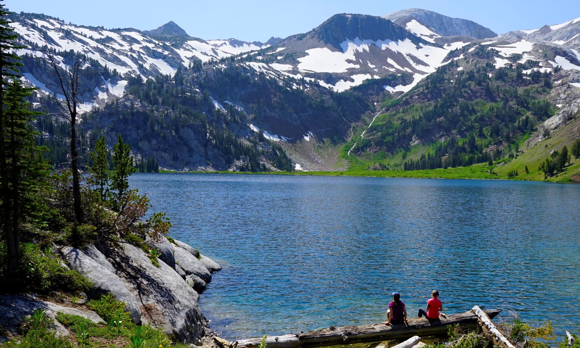
“I was up with the sun this morning y after taking a couple pictures near camp. I headed up the valley for Logan Pass. There is a excellent trail going over that is intended to be changed into a road as soon as possible. I lingered a while at the hanging garden, S.E. of the Pass … I also made a side trip over to see ‘hidden lake,’ when I came back to the pass several hiker had arrived so we all eat lunch y in the meantime a couple parties on horseback arrived. From there I took the trail N along the Garden Wall to Granite Park Camp. From the trail I could look up McDonald Creek, also down y see the lake, a small glacier on N side of Mt Albertine. I stopped a few minutes for a chat at the Chalet y was invited to partake of some sandwiches and cookies. From there I climbed up on top of Swiftcurrent Pass where I am camping tonight. I could easily have made it down to a more sheltered spot but I wanted to camp right on the Continental Divide once, this is abt 7175 ft. alt. It is blowing pretty hard from the W. but I am pretty well sheltered behind a dense thicket of small pine trees. Here is lots of snowing nearby y a small glacier about 1/2 mile away.
“There was a couple other campers came over to my camp for a chat last night, they also gave me a couple nice trout for breakfast. Then I headed up along the N.F. of 2 medicine creek. The lower part of the E. slope has all been burnt off a few years ago, but near the head of the creek I found green timber, mostly spruce. Here was a beautiful little lake with trout rising for flies all over it but it was too early for me to fish then. From there the trail up a very steep slope to the head of cut Bank Creek, from the top I looked down over a cliff several 100 ft deep into another lake of the very deepest blue it had a number of ice cakes floating in it.
The trail went down past this lake but I saw another old trail going to the top of the main divide only abt 1/4 mile so I went over there y had a look down the W side y it sure was worth while, high, bare, snowy peaks in all directions, from there I slide down part of the way to the trail on Cut Bank which I followed down. I was going to eat lunch at the upper lake, but the skeeters was awful thick! I guess up here they are just waking up. I passed 3 more little lakes y saw some rather large spruce trees, abt 3 1/2 ft ct. When going over to look down on the west side there was one place where I found a lot of blocks of Diorite. It surprised me at the time, but I had seen Diorite in Yosemite so I knew it right away. I also noticed a dark band, perhaps 50 to 60 ft wide running along the face of the cliff on the W side.
Well, I followed the creek down to the fork in the trail, then headed up … to Triple Divide Peak.
Unfortunately, two pages of Parsons from this day are badly worn and very hard to decipher, as you can see below.
“Friday the 4th. The men at the camp wanted me to sleep in their big dark tent last night with it all closed up but it got to stuffy so I too [sic.] my bed y went outside y fought mosquitos the rest of the night.* Because those [?] have been very bad the last 2 days y nights. This morning I had breakfast y they also insisted on me taking a lunch along. Instead of following the river down to [?] as I first intended, I headed up Morrison Creek from 3 Forks R.S. where I obtained a roll of film from the ranger’s wife. I followed this creek up for 9-10 miles to a fork in the trail where there was a telephone on a tree y a fire chaser camp. Here I first intended to take the left hand trail over to [?] creek but after going along this a little it swung almost S.W. so I came back y tok the other one which was a new one y going N. this I followed for abt 2 miles then that swung clear around E. y then S up a large creek so I came back to the tel. y camped and tomorrow I will give the first trail a trial again. Perhaps it is only temporary that it goes so much S.W. If I don’t follow it I will cut across abt N.E. it came a thunder shower while I eat lunch at Crescent Creek so I fixed up some mosquito netting form y bed y tonight while cooking supper I had another thunder shower. I was walking barefoot for several miles this p.m. the trail soft as velvet underfoot from half decayed tree old y needles y moss. It has been a little cloudy most of the day so it had not been so very warm.** There was a heavy smoke over the mountains to the W. last night.
*Parsons encountered a trail crew working a stretch of the trail he was hiking the day before. They invited me to stay for dinner and the night with them.
**Parsons often hiked barefoot, in part because he liked the feeling the ground beneath his feet and also to save wear and tear on his boots.
“That old Porky came back close to camp again after dark y he was deeding on something y grunting until he woke me up.* Well this morning I followed the trail up to the divide, there I climbed a high point near by to look over the country. The creek across the pass flowed W y then S.W. so it was out of the question unless I followed down for a ways y then headed up another creek to N but to the N I could see a big valley which I was sure must be the S. F. of the Blackfoot. To make sure I went down to the pass after my pack then climbed up over a very rough spur of a peak y dropped down on top of the divide which I followed N for a couple miles. This was right at timberline y beautiful country. There was snow in places but it was solid y good going, there was lots of flowers: Buttercups, Ememenies [sic], some small very blue forget-me-nots, heather, white y purple y 3-4 others. It was difficult to tell the main divide as there was high peaks in all directions one range going north y S.E of the valley y another, the range I was on, going W.
“L.E. in the Rockies 6/30/24”
Well I went down in that valley y had to fight brush, windfall y steep slopes for about 3 hours then a trail came down from an eastern tributary y followed down. Soon after I got a surprise where I found a sign which said Sun River Game Preserve.
So with all my careful planning I still was on the wrong river. It didn’t make very much difference as it also went N, but I thought I should be able to pick out my route even if I had only a poor map. I kept on going down until 4.30 when I found a nice location for a camp on a willow covered gravelbar. I had a bath y sunbath at noon y tonight I have been running around here stark nude for a couple hours.
“About 50 miles from anywhere”
I saw elk this p.m. I will follow along the creek down to the N.F. then up that one y across the divide again to Middle fork of Blackfoot which is a boundary of Glacier Park. That is not only the direct route to the park but also to supplies. I covered about 35-40 miles the last 2 days. This is one day again where I did not see anybody.
*The night before a porcupine (“Mr. Porky”) followed Parson down the trail and visited his camp.
“Yesterday morning I got over the summit shortly after I left camp. Then I came to a little meadow where an old trail followed the creek down to the NW y I came near going that way because the road went too far to the E to suit me, but finally I followed the road thinking it would most likely take me to Elliston. Well I came first to an old mine, then to several old placer diggings, then to another road that led up to a large mine called the Porphyry Dike Mine, then there was lots of roads branching off to other old mines, finally I came down to the town of Rimini, where I found out that I was still on the E side of the range. Finally after chasing around a while I collected enough information to find an old trail over the divide, this I followed up a very steep sloop to the top, from here I cut across for a while till I came to a place where somebody had started putting in a string of sluice boxes in a little creek, from here I found a trail down which came to a road and then down to the highway, past a large lime kilim and the shortly to town. Here I got some mail, but decided to stay over for today to wait for more, but expect to pull out tomorrow.”
Marguerite “Peg” Lindsley, image courtesy of the National Park Service.
“Thur 6/19 I felt much better yesterday morning so I hike merrily on, but it was cloudy y after a couple hours it started raining but I happened to pass an old deserted shack y stopped there while the worst got over then I hiked a few more miles but finally it got to raining hard again so as I just passed a little tow I dripped in to the restaurant y had a warm cup of coffee. While I was there a young lady came along driving a motorcycle, she was wearing boots, slicker coat y sou’wester y the rain had been beating in her face till she was al flushed. She stopped to die down her sidecar as it was bouncing too much, empty. I had a chat with her after I finished my coffee. She had been driving all the way from Philadelphia a few days before. She was the real thing, most self-sufficient young woman I had seen for a long time, she was one in a thousand that I liked right away, y I have been kicking myself for a silly ass never mind for not getting better acquainted or getting her name y address.”
A huge Thank You to the author Barney Mann, whos dogged detective work connected the dots between Pete Parsons rainy day encounter with Marguerite Lindsley. A year after her run-in with Parsons, Lindsley became the first permanent female Park Ranger at Yellowstone National Park. The National Park Service has a nice write up on Marguerite here.
“Tues 6/17 There was a couple elk [milling] around my camp this morning. I passed the Cliff in a short time also saw a couple good springs, then I cam to where the road cuts down through a beautiful rough, narrow gorge called the Golden Gate from there it was all down hill to Gardiner.
“Canary Springs 6/17/24”
At the Springs I looked around a little y tok some pictures then hiked on down to G. Here I left 8 rolls of film at the drugstore also got a check by mail y some other mail, then I was fool enough to buy a lemonade at the [something] and it made me as sick as a dog so I found a secluded spot y put a finger down my throat y got rid of most of it, but I felt miserable as I dragged my self out of town, y as soon as I could find a place to camp I just laid down, but tonight I had to out y tickle my throat again y still I don’t feel right, but perhaps it will be better in the morning.”
Parsons doesn’t mention it in his journal, but we know from his photos that he visits and passes through the Golden Gate, the Silver Gate, stops off at the Devils Kitchen, and Canary Springs before crossing the border into Montana and stopping in Gardiner.
For those that are interested the Yellowstone Insider has some interesting history on the Devils Kitchen. They note, “The Devil’s Kitchen is all but unknown in today’s Yellowstone National Park. Located east of Bath Lake in the [Mammoth Hot Springs area, the Devil’s Kitchen (for all its hellish imagery) was just a cavern—one regularly pumping out gases, of course. Further, it was itself the remains of a hot spring. What makes the Devil’s Kitchen interesting, in terms of Yellowstone history, is its uniqueness as a tourist attraction. In the early history of Yellowstone tourism, the Devil’s Kitchen was an interesting feature, despite featuring none of the hallmarks of a typical thermal attraction. It didn’t bubble, or pop, or flow, or cascade, or even hiccup. It wasn’t distinguished by its impressive colors.” Read more here.
It’s (way past) time to hit the books (and articles, podcasts, videos, and webinars)!
Most of us have a lot to learn when it comes to racism, anti-racism, and allyship in the United States, especially as it relates to outdoor recreation. There are hundreds of important resources available online, in the library, and through your headphones. Below are just a few of the outdoor-related ones that have resonated with the staff at the Mazamas, but trust us, time, a search engine, and a few keywords will be your biggest friends in this course on how to be a better human.
In their most recent report, “The Heat is On,” the Public Lands Trust analyzed park data from across the country to determine who does and doesn’t have access to this vital public resource—and uncovered some troubling findings. Download the report here.
Seeing White—Scenes on Radio, season 2 (14 episodes)
Videos & Movies
Pedal Through—A short film about finding healing through bikepacking. The film is part of the #OregonMade “Oregon’s Outdoors Are For Everyone” film grant series created by Travel Oregon and the Oregon Office of Film & Television.
Titan Project is a film about Sabrina Chapman, a Canadian sport climber with Indian & African heritage. Sabrina is on a mission to send her first 5.14a — the threshold for elite climbing. It’s also much more than that. It’s a story of one womxn’s journey of self-acceptance, healing, and resilience.
We realize this is a (very) incomplete list. Have you read or watched something pertaining to racism in the outdoors that you think should be here? Let us know! Share the pieces that have resonated with you in the comments below and we will get them added to our list!
“[Looking up] the upper Yellowstone River 6/14/24”
“Today I have just been plodding along down the river crossing several large creeks, abt 9 am I got to the lake y have been following the trail along its east shore the rest of the day. I have seen 70-80 elk y moose, lots of ducks, geese y several pelicans. This evening I saw white smoke around a point so I thought there must be somebody living but where I got there it was some steam vents in the rocks. I cooked a pot of rice over the one that seems very hot y [something] slightly, but here is on quite large that roars quite loud.
Page from Parsons journal
There is a thumping sound underground like a steamengine then here is a lot of little hot springs y several boiling mud-holes. I may sleep here tonight if the wind dies down a little, it usually does. It is blowing right off the lake who is quite rough along this north shore. I wish I had some brown beans y bacon, I would have a nice big pot full by morning. I expect to get to the highway in a couple hours tomorrow.”
“Yellowstone Falls 6/15/24”
Parsons doesn’t mention it but he’s crossed over into Yellowstone National Park and the lake he hikes along is Yellowstone Lake. Reading his journal today it’s amazing to think of a time when you could hike through Yellowstone, cook a pot of rice over a steam vent, and camp just about anywhere you wanted to. The following day Parsons leaves the lake and hikes up the Yellowstone River to Yellowstone Falls.