“Tues 6/17 There was a couple elk [milling] around my camp this morning. I passed the Cliff in a short time also saw a couple good springs, then I cam to where the road cuts down through a beautiful rough, narrow gorge called the Golden Gate from there it was all down hill to Gardiner.
“Canary Springs 6/17/24”
At the Springs I looked around a little y tok some pictures then hiked on down to G. Here I left 8 rolls of film at the drugstore also got a check by mail y some other mail, then I was fool enough to buy a lemonade at the [something] and it made me as sick as a dog so I found a secluded spot y put a finger down my throat y got rid of most of it, but I felt miserable as I dragged my self out of town, y as soon as I could find a place to camp I just laid down, but tonight I had to out y tickle my throat again y still I don’t feel right, but perhaps it will be better in the morning.”
Parsons doesn’t mention it in his journal, but we know from his photos that he visits and passes through the Golden Gate, the Silver Gate, stops off at the Devils Kitchen, and Canary Springs before crossing the border into Montana and stopping in Gardiner.
For those that are interested the Yellowstone Insider has some interesting history on the Devils Kitchen. They note, “The Devil’s Kitchen is all but unknown in today’s Yellowstone National Park. Located east of Bath Lake in the [Mammoth Hot Springs area, the Devil’s Kitchen (for all its hellish imagery) was just a cavern—one regularly pumping out gases, of course. Further, it was itself the remains of a hot spring. What makes the Devil’s Kitchen interesting, in terms of Yellowstone history, is its uniqueness as a tourist attraction. In the early history of Yellowstone tourism, the Devil’s Kitchen was an interesting feature, despite featuring none of the hallmarks of a typical thermal attraction. It didn’t bubble, or pop, or flow, or cascade, or even hiccup. It wasn’t distinguished by its impressive colors.” Read more here.
“[Looking up] the upper Yellowstone River 6/14/24”
“Today I have just been plodding along down the river crossing several large creeks, abt 9 am I got to the lake y have been following the trail along its east shore the rest of the day. I have seen 70-80 elk y moose, lots of ducks, geese y several pelicans. This evening I saw white smoke around a point so I thought there must be somebody living but where I got there it was some steam vents in the rocks. I cooked a pot of rice over the one that seems very hot y [something] slightly, but here is on quite large that roars quite loud.
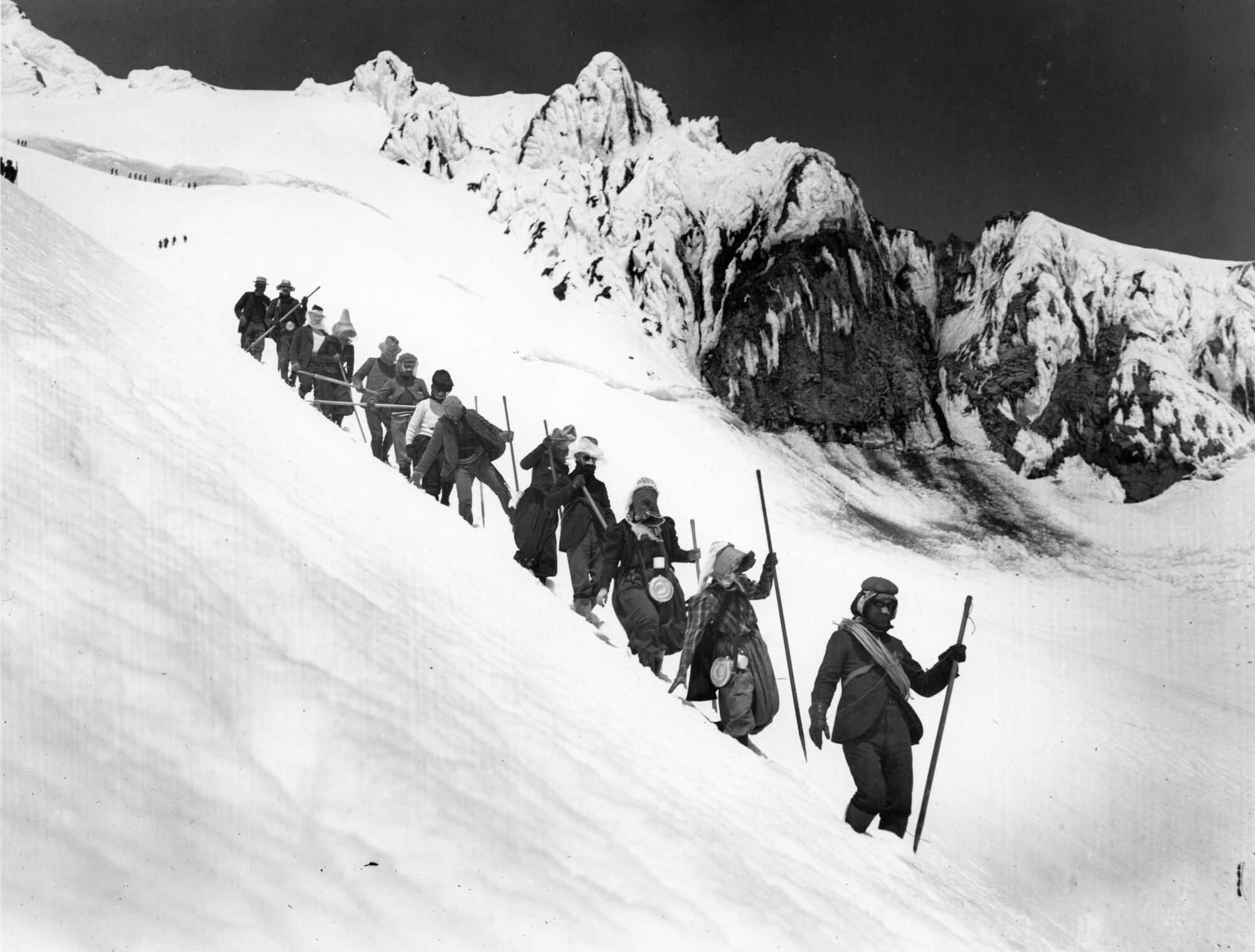
Page from Parsons journal
There is a thumping sound underground like a steamengine then here is a lot of little hot springs y several boiling mud-holes. I may sleep here tonight if the wind dies down a little, it usually does. It is blowing right off the lake who is quite rough along this north shore. I wish I had some brown beans y bacon, I would have a nice big pot full by morning. I expect to get to the highway in a couple hours tomorrow.”
“Yellowstone Falls 6/15/24”
Parsons doesn’t mention it but he’s crossed over into Yellowstone National Park and the lake he hikes along is Yellowstone Lake. Reading his journal today it’s amazing to think of a time when you could hike through Yellowstone, cook a pot of rice over a steam vent, and camp just about anywhere you wanted to. The following day Parsons leaves the lake and hikes up the Yellowstone River to Yellowstone Falls.
6/11 I took the trail about 6 am. It was pretty wet going, I got up to the upper lake (2m) here y saw quite a number of ducks but I left them alone, from there I expected to have quite a climb to the pass so I was very surprised when the trail came near the creek after having left it for a short distance, to find that the water flowed north instead of south, I was going down towards Buffalo creek all ready, there was quite a lot of snow in the timber but I soon got down to an open grassy park, and here I nearly stumbled on an elk but he was too far away by the time I got my camera in action, but there also was a big, fat porcupine and I believe I got his picture although I had to take it on the run. After going down a little more I crossed the creek and began climbing up on to a lot of open park on the hillside here I first saw 1 elk laying down some distance away the I had close view and a picture of 4 bulls y later on I saw several more [unintelligible] y got another picture of 4 cows, so I have seen 8 today. Well, after a while I had another snowy slope down to Buffalo Creek. The [unintelligible] told me last night
“Elk along the Buffalo”
that I could not cross the Buffalo without swimming, but after I had decided on the best place I stripped off and waded across, walking a little downstream y using a stick to steady me the water was very cold so after rubbing my legs good I crossed back then got my outfit and crossed the third time. Then I eat lunch before I started out again. From here I expected to find another trail branching off to 2 Ocean Pass y if I didn’t find it I would first follow the creek down to where the Highway crosses. Well, I didn’t find the Trail ( I expect I should have gone upstream a ways instead) it was interesting country unspoiled by civilization y I saw elk … y than in some places the river runs through a narrow, rough gorge. The main trail crossed the [something] a couple times, but as it was to big to ford here safely I managed to get along on the N side by climbing around the cliffs a couple of times finally I cam out on high bench-land covered thickly with LP Pine. Here I lost the trail but followed elk trails for a while but where I saw the rive again I could hardly
figure out which direction it was flowing. but I decided it must be Soda Creek coming down to it and it joined the river in a very peculiar manner.
Well, after crossing the creek I found the trail so I thought I might as well camp especially as I got m pants wet in crossing. Well, it has been rather wet y hard going, but I have seen the Elk in their natural surroundings and native haunts y I have enjoyed it very much, I only wish I had found that trail today. I saw several grouses [unintelligible] y a number of new flowers as I have been walking along I have been comparing the country with Alaska it is very much the same thing at this time of the year. It is getting more pleasant weather for camping out. This morning at 4.30 it was warm enough so I could strip off and take a good rub down before dressing.
“Looking up the Buffalo River.”
7 pm. Just now I heard some elk bugle y I can see 5 across the river with 2 calves. There also is a couple grouse drumming nearby. Jeh, I hate to go back to the highway.”
As noted before, Parsons is in Dubois, Wyoming, waiting out the weather. While there he finds work installing electrical wiring in cabins. It continues to snow on and off over the next thirteen days. Although his journal is blank between May 29 and June 10, his photo albums show that on June 8 he attends a round-up of wild horses. His only images from his time in Dubois are labeled “Roughriding in Dubois.”
Over the previous days, Parsons traveled across Wyoming, from Fort Steele to Dubois. In general, he found it mostly flat and “uninteresting.” In some cases he traveled along existing roads and from time to time was picked up by a passing motorist. On the 28th, he got a ride and covered 65 miles between Lander and Circle. In Lander, Wy, he stops to buy groceries and mentions buying a copy of Outdoor Life magazine, “in which I found a brief description y a few pictures of my last year’s trip.” If you are reading this, and happen to have a copy of the April or May 1924 issue of Outdoor Life magazine, we’d love to see Parsons article!
“This has been my longest days travel because I rode abt 65 miles. At first, it was raining quite hard last night y my fly was leaking some too, but I managed to keep my bedding dry anyway. The snow was way done in the hills this a.m. y it was [illegible] a little of and to after. I got on my road, then after a few miles I got a ride with a fellow from Lander all the way to Circle, it was through a rather uninteresting section of the country except perhaps a little along the Little Wind River. Then from Circle I started walking up to Dubois but after a couple miles it started hailing and raining which gradually turned to heavy snow. I put my tent over my back and kept on, but finally I almost had made up my mind to try to find an empty shack at one of the ranches but by this time a couple fellows overtook me in a car y gave me a lift. The car was skidding y sliding all over the road y one man had to keep wiping the windshield continually but we finally got into town.
Dubois, Wyoming
Here I tried to find an empty cabin, but finally took a room at a hotel, also I had made up my mind to try to find a job y stay over until the weather to better. I finally got an offer of some work from one of the storekeepers who is also a rancher owner y banker.”
Over the past couple of days Parsons has made his way out of Colorado and into Wyoming. Between the 19th and the 21st, he hikes across the Medicine Bow mountains. On the 20th he notes, “Well, Saturday night I camped at the head of the Fall River, which drains into the Mississippi, last night I camped at the head of the Colorado River y tonight at the head of the Michigan Creek who runs into the Platte y then on to the Mississippi, so I actually crossed the divide twice although I have been going west the last 2 days.” By the 20th he’s out of the mountains and deep into the Platte River valley, “rather boring sagebrush country, nothing much of interest.”
“Sagebrush camp”
On the 22nd he wrote “I hiked all the 20 miles to Saratoga today, arrived there at 12. There I bought a few supplies and struck out again, the road followed the Platte River which flows north y as I was looking on the river I said to my self, why not tie a raft together y travel by water for a ways. So I went down along the riverbank looking for some logs y collected some fence wire from an old fence.” The next day he floats the North Platt River almost all the way to Fort Steel, Wyoming, roughly 40 miles. The next morning he watches antelope from camp before hitting the trail again.
“In Wyo 5/23/24”
It was not uncommon for Parsons to build a watercraft on the fly and make use of it. Sadly, his collection does not contain a photograph of the raft he built and floated on the Platte River.
Look for a future post that explores his fascination with watercraft and showcases several of the boats he built over the years.
“Sun 5/18 I had a good sleep last night y the morning was bright y clear. I was up at 4 am y on the way at 4.45. I was on the summit of Fall River Pass (11797 ft alt) at 6 am. It was very windy up there y cold, then I had several miles above timberline then down to a lower pass, part of this way the road was along very steep side hills y as the road was [unintelligible] I had some rather difficult [unintelligible] to get over. From the last pass I went right down (where there was supposed to be a trail under the snow) to one of the small tributaries of the Colorado River, here I found a ranch y tourist camp where they told me I could cross the next range by gong up the creek to where there was a large irrigation ditch that crossed a low pass, then follows the ditch up to a camp y from there it was a trail across the pass to the northeast.
“Climbing Lulu Pass 5/18 5:20 am”
Well I followed the creek up for aways then had abt. a 1000 ft climb up a steep slope to the ditch through soft snow where I sunk down to my hips sometimes. Then when trying to follow the ditch it was the same thing, so I found a couple of boards that I tied on my feet as snowshoes and got along fairly well y got to the camp at abt. 1200. Here I was treated to dinner y I guess I will get [unintelligible] stay around one of the cabins tonight as here is 2 to 10 ft of snow everywhere around here.”
This story was originally published in the 1980 Mazama Annual along with Marianna’s original artwork and seven photographs of the eruption taken by Ty Kearney.
“This is just like climbing up over a football!” I thought as I worked my way up Mount St. Helens on my first climb of June 24, 1945. Led by Don Onthank, this Mazama ascent was my second major peak and exciting because we were doing a new route – the Northwest Face*. That night under the moonlight, we picked our way along the sandy lip overlooking the yawning chasm of the Toutle. Our figures cast picket fence shadows in the pumice and the mysterious night air began to lose its chill as dawn drew near.
Thirty-five years later my husband, Ty Kearney and I, sat comfortably in our van observing the west slope of the mountain, and the Northwest Dome where I retraced our old climbing route. But now it was a different mountain; the dazzling whiteness had been replaced by a kind of lunar barrenness and the peak looked grim with its powdering of dirty pyroclastics. With purple grey ash spilling down the light grey pumice fields, the mountain’s image had a strange reversed effect like a photographic negative. At this stage the eleven glaciers were ash covered; six feet had crumbled from the summit into the new crater on the northwest side. High up on that side a bulge of rock and ice, growing at the rate of five feet a day, was causing alarm. No one dared climb the peak now, nor were they permitted to.
From our viewpoint, the Toutle Canyon was a focal point; another eruption could trigger a mudflow which would cause flooding down the lower Toutle; we watched this area with special care as we check-looked the mountain. We had volunteered to “volcano watch” for the State Department of Emergency Services, for a one-week mission. A part of RACES network (Radio Amateur Civil Emergency Service), we had been assigned to observe the west side from a logged-over area two and one half miles northwest of Goat Mountain. Eight miles from the summit on Road 5700 at 4,240 feet, we were perched high enough for occasional sleet and snow. It was May 13th. Our Van was parked just outside the red zone with a fine view of the mountain.**
With nearly zero visibility, the first few days brought only fleeting glimpses of the summit crowned in new snow. We walked the soggy, ash-dusted earth and logging slash, admiring the fragile avalanche lilies or looked down on a logging operation in a tributary of the South Fork of the Toutle. We copied daily seismic reports originating from the University of Washington, relayed to the net by a “ham” station in Seattle. (Of the thirty “events” daily, only from seven to ten of them were harmonic tremors of over 4.0 in intensity.) The mountain seemed quiet. However on two separate nights we drove down to Yale Park, not only to seek relief from the chilling winds, but also as an “escape route drill.” Too, we had felt uneasy camping at night with no view of the mountain.
On Friday, May 16th, we watched large private helicopters ferrying equipment out of hazardous areas. By Saturday, the 17th, a glowing sunrise had burned away the last shreds of the fog curtain and ushered in perfect visibility. The seismic report came in late but seemed routine. By afternoon, a series of dust clouds combined into a bright fleecy cloud which cast a deep blue shadow on the upper southwest slopes; on the opposite side the bulge appeared to warp the upper northwest skyline.
The gash of the Toutle Canyon showed pinkish-grey in the flat light and all was quiet and bright except for wisps of steam issuing from the two upper vents near The Boot. For awhile a helicopter carrying geologists perched on the crater rim itself. A “ham” in Olympia called asking about avalanches in the Toutle. By late afternoon a new volcano watcher, Gerry Martin, had driven his motorhome to a location near Coldwater Peak, seven miles north-northwest of the mountain and about ten and one-half miles northeast of us. Via “ham” radio, we began to get acquainted with him when our first visitors of the week arrived for dinner. This included a friend outside shoveling up ash covered snow to take home. Their visit climaxed a full day and after they left we watched the mountain looming in a star sprinkled sky, seemingly peaceful. Then I remembered a remark about Mount St. Helens I’d just heard over the radio: “A watched pot never boils,” and I felt a little uneasy.
Sunday, May 18th, arrived in a blaze of scarlet but with a light overcast. Visibility remained good however with Mount Rainier showing pearly white. It was 47 degrees F., with no wind. Between seven and eight a.m., Gerry and Ty discussed two small steam vents up near The Boot (“North 2”), a rock formation below the crater rim, on the northwest side. I was sitting on a folding chair sketching when the tranquility of the morning was shattered by Ty’s shout over the mike: “We’re in an earthquake!” (The time was 8:32) Gerry confirmed that he’d felt it too. (Later reports set the quake at magnitude 5.0). Less than one minute later I looked up to see a black cloud silently boil up out of the summit. “What an interesting show!” I thought as I watched a second large cloud being laterally blown out of the north side. Scarcely had the thought surfaced when enormous black clouds ballooned out. One of them spewing out huge rocks and glacial ice.
Stunned, I watched convolutions, coalesce into a monstrous pall that enveloped the entire summit in a ravenous mass. Etched in silver, the velvet-black billows growled like distant muffled thunder and expanded at an incredible rate. Ty meanwhile had witnessed the lower part of the Goat Rocks formation slide away. The two young men (Robert Rogers and Frank Valenzuela) who had camped nearby had just zoomed out in a cloud of dust.*** Ty wondered if he dared take any pictures and still beat the cloud. He made a snap decision and took seven, hand-held. Over the radio we could hear Gerry’s voice, coming from the Coldwater Peak area, now in the path of the holocaust: “I’ve got to try to back out of here!” By now the black cloud, complex and banded with steam, had cascaded out in a lateral blast of unbelievable proportions, hugging the earth and racing at a speed of some 350 miles per hour. It then fanned out, engulfing not only Gerry but photographer Reid Blackburn and geologist Dave Johnston, also working in the area.‡ Ty then noticed that an edge of the black cloud was descending into the South Fork of the Toutle Canyon, our last protection from the exposed ridges we were on. “LET’S GET OUT OF HERE!” he shouted.
USGS Photograph of May 18, 1980 eruption.
Slamming the van top down, we took off on the longest seven-mile ride of our lives. Though the car was under control we seemed to be flying at breakneck speeds over the rough forest roads. I knelt on the floor of the van, holding the radio on the tiny table, being showered by falling objects from a cupboard that had popped open over my head. Static screamed on the radio. Someone’s voice pierced the roar: “Which way are you going?” “South!” I answered, although for the first mile and one-half, our route had actually taken us eastward toward the volcano before it turned south.† For those terrifying moments we forgot communications as we faced the inferno of the exploding mountain.
Out of the van windows, death threatened us in the form of an ash cloud so immense it literally filled the sky. It was dirty-grey and suffocating with darker columns slowly rising to a billowing mushroom top. It was a monstrous mural rendered in pastels of swirling greys, deep, mysterious, and breathing terror everywhere. Swipes of lighter grey, some vertical, some horizontal, gave dimension to the hideous smoky chamber that now flashed with bolt lightning. It was almost beyond conception, an unimaginable evil, abstracting bizarre patterns of twisting smoke and hot gases ascending to the roof of Hell. In a race against time, our frail vehicle hurtled through a nightmare world dominated by the cloud that dwarfed everything by its sheer magnitude. The spindly alder trees near Fossil Creek swayed slightly before the churning greyness as we passed. Against the deep gloom, the pale sickening grey of the cauliflower column of the vertical eruption writhed upwards, carrying its load of ash and superheated gases. For a while, a blue car followed us, speeding down the road in its own private escape from a horror movie. Then it turned off, leaving us alone. The last thing I recall before we reached the relative safety of the Lake Merrill basin which lay below the exposed ridge, was a swelling dark grey billow, rimmed in sunlit silver and boldly edging the sky’s soft blueness. All was mercifully quiet – nearby a man on a motorbike had paused to take a picture from the bank.
Marianne’s hand drawn map of their escape route off Mount St. Helens.
We breathed silent prayers of thanks. The edge of the cloud appeared miraculously, steam whitened, rising gracefully like a fountain to a scalloped, saucer-shaped disc, softened by swirling effects and lens-like curves. The disc shape repeated itself in a lower cloud. At the junction of N818 with Highway 503, just west of Cougar and about twelve miles below our camp, we passed a roadblock, then bordered Yale Lake where people were driving toward the mountain to sightsee. Soon we were in green country again, climbing the rolling hills near Amboy on paved roads. Never had green and growing things looked so beautiful! Though church bells were ringing for Sunday School at Hazen Chapel near View, people remained outside watching the volcano in its biggest eruption in nearly 3,000 years, as it poured multiple pillars of ash and steam 66,000 feet into the hazy blue sky. We turned away from the black horror of a sunny day in May and drove home, experiencing a strong sense of unreality. We knew that people like ourselves had died in the terrible blast of our once serene Mount St. Helens. We had been allowed to live. We felt humble.
Author’s Notes: * See “Mazama,” Dec. 1945, pp. 72-73 and p. 91 ** Though I heard nothing except a low growl shortly after the first eruption, the initial “boom” was heard as far away as Penticton, B.C., 250 miles to the north. We also felt none of the tremors until the quake that set off the May 18th explosion. Perhaps it was the apparent silence of the giant explosion that contributed to its unreality. *** The young men who preceded us out later reported that the area of our camp received only light ash but the gas cans we had abandoned in our hurry were very warm. ‡ Gerald (“Gerry”) Martin is still among the missing but presumed dead, since part of the ridge he was on was removed by the blast. Prior to his assignment in the Coldwater Peak area on May 17th, he had spent many hours of volcano watching in another location on the north side. Mazamas Bill and Jean Parker who also perished in the blast were located eleven and one-half miles northeast of our camp, and two and one-half miles northwest of Gerry. They were nine miles from the summit. † We estimate that only about a half mile separated us from the blast cloud as we reached the point on the road where it turned from east to south. Though eight miles from the summit, our camp and the first leg of the journey out were about five and one half miles from the base of the mountain.
In the photo above we see Parsons backpack for the first time. Just barely visible are the words “Heading north Mexico to Canada.”
“I was on the way at 6 y got down to the town of Estes Park abt 8. Here I had a 2nd breakfast (although it didn’t amount to much except in price), bought a few groceries as there is 40-50 miles to the next town y 3 high passes to cross.
“Estes Park Colo 5/17/24”
Well, after that I followed the road up Fall River abt. 13 miles and am camping less than 1000 feet below timberline. I will try to get an early start tomorrow y get as far as possible before the snow gets too soft. The country along Falls River is in the park but it is privately owned along both sides for miles, I expect that later in the summer it would be almost impossible to get a drink of water along there for miles with out trespassing on somebody.”
Parsons doesn’t say much about his time in Denver. He arrives on the morning of the 12th and leaves the following morning. He did, however, take time to visit the Colorado Museum of Natural History and found it very interesting. He laments not having more time to spend exploring the museum. On the 13th he takes the streetcar out to Golden and from there hikes back into the hills.
May 14, 1924. “Today it has been mostly ups y down the whole on easy slopes through as I have been following the road the whole day. At first I was heading for Central City, a large mining camp, but afterwards I found out that I could get to Rollinsville and towns to the north without going to Central City, so I tok [sic] a short cut over to Rollingsville and am camping about 1/2 mile north of there tonight.
There is an other town a few miles north of here where I can bye supplies before I get to the Park. This is a great mining section (or has been) there is mines on the hillsides in all directions. There is a lot of snow around here and up around the last saddle I crossed it was 2-3 fet. deep all over in the timber with potholes in the open also. This is above 9000 ft. alt. I expect the park will be mostly under snow. “
Although his journal doesn’t note it, the notation on the list contained within his negative collection does. The notation for image #71 states “5/14 the Continental Divide.” Cross-referencing a rough estimate of his route has him crossing over the Divide at some point on May 14, 1924.
Thanks so much for fixing the link! It works, now! – leora
It appears that the link for “take action now” is missing. At least, it doesn’t go anywhere for me.
I vigorously oppose PG&E taking the proposed initial grab on First Park. Their deceptive ploy of waiting until the last…
Well done and thank you! I, too, wrote a letter about this issue on 12/2/24: As an active member of…
Mr. Kruell, glad to see you are back in the fold again. I sleep better at night knowing you are…


Thanks so much for fixing the link! It works, now! – leora